Arbor Day
Author: Ziya Bacchus, Ariel Yong, Olisa Pantlitz | Edited By: Sarah Reid | Published: 26/04/2024
Dr Richard Leakey said, “We make an immense mistake when we think of trees as solely an aesthetic member of a community. They cut pollution, they cool the air, they prevent erosion, they muffle sound, they produce oxygen. Then, after all that, they look good.” When we use the tree economically and respecfully, we have one of the greatest resources on earth.
Arbor Day is one set aside to promote the preservation of trees by carrying out tree planting exercises and other activities that highlight the importance of trees. It originated in the United States in 1872 when J. Sterling Morton proposed a day dedicated to tree planting in Nebraska. The first Arbor Day was celebrated on April 10, 1872, with an estimated one million trees planted (Arbor Day Foundation, n.d.).
It was later recognized as a legal holiday in Nebraska. Arbor Day has since spread to many countries around the world, often with variations in the date and customs. The date of Arbor Day varies depending on climate and planting seasons in each region. However, the common theme across all these countries is the celebration of trees and their importance to the environment (American Arborists, 2017).
Trees are essential for sustaining a healthy environment and ecosystem. They produce oxygen, absorb CO2, improve air quality, and serve as habitat for a variety of animal species (Savatree, 2021). Trees also prevent soil erosion, minimise noise pollution, and provide shade and cooling in metropolitan settings.
Planting trees is critical for combating climate change because they operate as carbon sinks: absorbing and storing CO2 from the atmosphere (Arbor Day Foundation, n.d). By planting more trees, we can aid in reducing greenhouse gas emissions and alleviate the effects of global warming. Furthermore, trees contribute to community well-being by improving neighbourhood aesthetics, increasing property prices, and instilling a sense of calm and relaxation (Tree People, 2024). They are instrumental in improving mental wellness and reducing stress.
The planting of trees holds high significance to Guyana's environmental sustainability. Over the years notable tree planting exercises have included the National Tree Planting Exercise by First Lady Arya Ali on Earth Day in 2021 which emphasised the importance of tree planting for environmental conservation (Newsroom, 2021). As well as the President Dr M. I. Ali's involvement in Tree Planting along Lamaha Street in 2023 which highlighted governmental support for environmental initiatives (Guyana Chronicle, 2023).
However, one of the most notable tree planting exercises has been the mangrove restoration project undertaken in strategic parts of Guyana. The Guyana Mangrove Restoration Project (GMRP) was introduced in 2010 with monetary funding from the Eurpean Union and Government of Guyana (Sharples, 2017). It aimed to build up the coast's natural sea defences against the Atlantic Ocean since parts of the coastline are nearly five feet below sea level at high tide (Sharples, 2017).
The Restoration Project (GMRP) successfully planted 88,000 mangrove seedlings from La Bonne Intention to Success, East Coast Demerara. This covers an area of 1.89 km. In Wellington Park, 32,743 seedlings were planted covering 0.46 km. In addition, a total of 78,000 seedlings were planted from No. 6 to 8 Village, Berbice (KNews, 2012). These replanting projects were backed up by several public awareness activities to sensitise the public of the importance of having mangroves as a natural form of sea defence (KNews, 2011). Replanting was done on the foreshore utilising residents of the various communities (KNews, 2012).
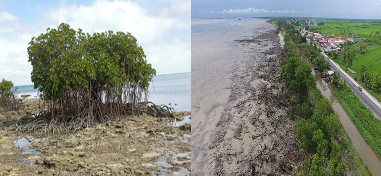
Figure 1: Mangrove trees and coastline in Wellington Park (KNews, 2012).
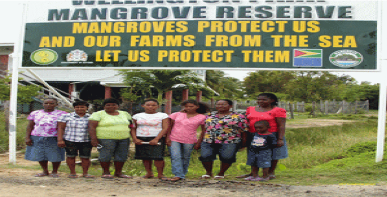
Figure 2: Mangrove Restoration sign (KNews, 2012).
Sharples (2017) in his report noted that about 142 hectares of mangrove forest were restored along Guyana's coastline since rehabilitation efforts started. Additionally, although the GMRP officially ended in 2013, the Mangrove Restoration and Management Department within the National Agricultural Research & Extension Institute (NAREI) continues to carry on the legacy (Sharples, 2017).
Arbor Day serves as a platform for Guyana to reinforce its commitment to environmental preservation through the restoration and protection of mangrove ecosystems. Mangrove tree planting exercises are crucial for Guyana's green future, contributing to coastal protection, biodiversity conservation, and climate resilience (Guyana Chronicle, 2023).
The value of trees and planting trees cannot be overemphasized. They are essential to our planet's health, community well-being, and environmental sustainability. It is critical that we continue to plant and protect trees so that future generations can enjoy a greener and healthier future.
References
American Arborists. (2017, April 28). Celebrate Trees! A Brief History of Arbor Day. American Arborists. https://www.americanarborists.net/tree-tips/2017/april/celebrate-trees-a-brief-history-of-arbor-day/
Arbor Day Foundation. (n.d.). History at arborday.org. Www.arborday.org. https://www.arborday.org/celebrate/history.cfm
Arbor Day Foundation. (n.d.). Trees help fight climate change. https://www.arborday.org/trees/climatechange/#:~:text=As%20trees%20grow%2C%20they%20help,benefits%20to%20us%2C%20every%20day.
Guyana Chronicle . (2023). President Ali in tree-planting exercise - Guyana Chronicle. Guyanachronicle.com. https://guyanachronicle.com/2023/01/22/president-ali-in-tree-planting-exercise/
KNews. (2011, October 12). Mangrove Restoration Project takes shape at Wellington Park. Kaieteur News. https://www.kaieteurnewsonline.com/2011/10/12/mangrove-restoration-project-takes-shape-at-wellington-park/
KNews. (2012, May 21). Mangrove seedlings being planted along coastline. Kaieteur News. https://www.kaieteurnewsonline.com/2012/05/21/mangrove-seedlings-being-planted-along-coastline/
Newsroom. (2021, April 22). First Lady launches national tree planting exercise on Earth Day. News Room Guyana. https://newsroom.gy/2021/04/22/first-lady-launches-national-tree-planting-exercise-on-earth-day/
SavATree. (2021, October 28). The importance of trees - learn value and benefit of trees. https://www.savatree.com/whytrees.html#:~:text=Trees%20contribute%20to%20their%20environment,preserving%20soil%2C%20and%20supporting%20wildlife.
Sharples, C. (2017, July 13). Going under: mangrove restoration in low-lying Guyana a vital need, say experts. Mongabay Environmental News.https://news.mongabay.com/2017/07/going-under-mangrove-restoration-in-low-lying-guyana-a-vital-need-say-experts
TreePeople. (2024, March 25). 22 benefits of trees. https://www.treepeople.org/22-benefits-of-trees/
World Forestry Day
Author: Dominic Budhan & Ziya Bacchus | Edited By: Ariel Yong | Published: 23/01/2024
World Forestry Day, also known as the International Day of Forests, is observed annually on March 21st. This day was established by the United Nations General Assembly to raise awareness about the importance of forests and trees and to promote sustainable forest management worldwide. Each year, World Forestry Day focuses on a specific theme related to forests and their conservation. This year’s theme is “Forests and Innovation: New Solutions for a Better World” (United Nations, 2020).
Forests are the lungs of the Earth, purifying the air we breathe and regulating the climate by absorbing carbon dioxide and releasing oxygen. Beyond their environmental significance, forests are also crucial for the social, economic, and cultural well-being of communities around the world (Vedantu, n.d.).
Forests are hubs of biodiversity, housing millions of species of plants, animals, and microorganisms. They serve as invaluable reservoirs of genetic diversity, providing a vast array of resources essential for the development of medicines, food crops, and other products critical for human survival (Centre for International Forestry Research, n.d.) . Additionally, forests provide habitat for indigenous communities and countless other societies whose livelihoods depend on the sustainable use of forest resources.
Moreover, forests are vital for maintaining water cycles and ensuring the availability of clean water for drinking, agriculture, and industrial purposes. Forested watersheds act as natural filters, preventing soil erosion and sedimentation, and regulating the flow of rivers and streams (Food and Agriculture Organization of the United Nations, 2019) . Protecting and restoring forested areas is therefore essential for safeguarding freshwater ecosystems and ensuring water security for present and future generations.
Furthermore, forests play a pivotal role in mitigating the impacts of climate change (United Nations, 2023) . As carbon sinks, forests sequester vast amounts of carbon dioxide from the atmosphere, helping to mitigate global warming and reduce greenhouse gas emissions. Sustainable forest management practices, such as afforestation, reforestation, and forest conservation, are essential strategies for combating climate change and building resilience to its adverse effects.
References
Centre for International Forestry Research. (n.d.). Forests and biodiversity. Www.cifor.org. https://www.cifor.org/Publications/Corporate/FactSheet/forests_biodiversity.htm
Food and Agriculture Organization of the United Nations. (2019). FORESTS: NATURE-BASED SOLUTIONS FOR WATER. https://www.fao.org/3/ca6842en/ca6842en.pdf
United Nations. (2020). International Day of Forests. United Nations. https://www.un.org/en/observances/forests-and-trees-day
United Nations. (2023, March 21). Healthy forests, healthy planet, healthy humans | UN News. News.un.org. https://news.un.org/en/story/2023/03/1134677
Vedantu. (n.d.). Importance of Forest. VEDANTU. https://www.vedantu.com/chemistry/importance-of-forest
Urbanisation in the Caribbean
Author: Lalta Sugrim & Olisa Pantlitz | Edited By: Sarah Reid | Published: 31/01/2024
Urbanization is the migration of people from rural to urban areas for a variety of opportunities. In the Caribbean, urbanization is complex because of slavery, indentureship and agricultural resource exploitation (Dehoorne et al., 2018; Boswell, 1991; Potter, 2000). Emancipation also influenced Caribbean population distribution as ex slaves concentrated on certain lands. After the territories gained independence, they took control of agricultural diversification and investments in tourism and manufacturing. However, the legacy of Britain lingered as the territories still exported primary products to be manufactured elsewhere. Overtime there was little development in manufacturing and service industries which helped drive Caribbean people to urban areas in search of jobs and other opportunities (Haggerty, 1989; UNCTAD Development and Globalization: Facts and Figures, 2021; Dehoorne et al., 2018; Boswell, 1991; Potter, 2000).
One Caribbean urban centre is Kingston, Jamaica that was founded in 1692. It is the capital, the most densely populated area and the hub for businesses and services. After independence from colonial rule, urban growth was not planned with efficient land use and expansion of cities was an afterthought. As such in 1900 there were 60,000 people in Kingston, however in 1990, the population increased to 906,000; almost 38% of Jamaica's total population (2,400,000). Due to its rapid rate of unattended urbanization, the proper social, physical, and economic growth of the city was prevented. Roadways were irregularly shaped and ill-planned which created disorder as opposed to the colonial rectangular structure. Businesses emerged along roadways, competing with the older Kingston core area (Haggerty, 1989; UNCTAD Development and Globalization: Facts and Figures, 2021; Dehoorne et al., 2018; Boswell, 1991; Potter, 2000).
The physical growth of Kingston and of its urban population led to economic segregation where the wealthiest lived on the outskirts and the poorest lived in slums around the center. The labour force was also not maximized due to limited job creation and growth. This limitation stemmed from the lack of industries which in turn caused a boom in the informal economy; at least 50% of the city’s labour force were employed in the informal sector at one point (Boswell, 1991; Zegans & Danker, 2021; Clarke, 2006).
In the 1970s implementation of policies helped resolve the ills of urbanization. Furthermore, the influence of globalization spurred growth in the economy, increased tourism, investments, and job creation. This is since foreign entities expanded and brought different opportunities to the Caribbean region (Haggerty, 1989; UNCTAD Development and Globalization: Facts and Figures, 2021; Dehoorne et al., 2018; Boswell, 1991; Potter, 2000).
In addition to investment in industries, countries have recognised the need for secondary cities to reduce the concentration of people in the primate city and move them away from the coast. In Jamaica, the concentration of people stemmed from improper planning and this placed a strain on city services and the already limited jobs. Guyana for instance, remained a primarily rural country up to 1991. The capital city Georgetown, housed over 80% of the urban population. The other towns functioned as regional centers (Merrill, 1992). By 1985, 32% of the population lived in urban areas situated along the coast mainly to further their studies and take up job opportunities. This has placed a strain on the city services overtime (Merrill, 1992). In Guyana 26.8 % of the population was urban (218,143) in 2023 (Worldometer, 2023). This presents a decrease partly stemming from Government investment in jobs and services within rural areas.
A noteworthy mention is the Silica City model. In order to reduce the strain on the coastal primate city, the plan for a new urban center, Silica City, was created. According to the city land use plan, it will be divided into 12 zones that are components of smart city interventions. The residential zone will be the largest, covering 2,146 acres. Tourism, sustainable drainage, alternative energy, waste management, and agriculture are all planned components (OilNow, 2023; Gutierrez, 2023). Moreover, it is envisaged that the city will feature a multimodal road network that can accommodate different levels of transit and pedestrian traffic alongside a train system (OilNow, 2023). The development of a secondary city in an inland, previously rural area will spur growth and development.
In summation after independence there was unattended urbanization and limited planning within Caribbean territories. Many individuals left rural communities to take up the limited jobs in the city which were stifled due to a lack of investment and industry. However, in recent times policies have been implemented for instance in Jamaica to curb the ills of urbanization. Globalization has also placed many Caribbean territories on the world front, opening them up to investment and job growth. Countries like Guyana have furthermore been investing in job creation within rural areas and the development of inland urban centers like Silica City. All in all urbanization in the Caribbean has transformed overtime to improve the economy and livelihoods of people.
References
Boswell, T. D. (1991). CHARACTERISTICS AND PROCESSES OF URBANIZATION IN THE CARIBBEAN. Yearbook. Conference of Latin Americanist Geographers, 17/18, 67–90. http://www.jstor.org/stable/25765740
Clarke, C. (2006). Urbanization in Kingston since Independence. Decolonizing the Colonial City. https://doi.org/10.1093/oso/9780199269815.003.0011
Dehoorne, O., Cao, H., & Ilies, D. (2018). Study the Caribbean City. Études Caribéennes, 39-40. https://doi.org/10.4000/etudescaribeennes.12773
Gutierrez, B. (2023). School of Architecture to design a smart city in Guyana. Retrieved from https://news.miami.edu/stories/2023/12/school-of-architecture-helps-design-a-smart-city-in-guyana.html
Haggerty, R.A. (1989). Dominican Republic: A Country Study. Washington: GPO for the Library of Congress. http://countrystudies.us/dominican-republic/
Merrill, T. (1992). Guyana - Urban Population. Countrystudies.us; U.S. Library of Congress. https://countrystudies.us/guyana/26.htm
Potter, R.B. (2000). The Urban Caribbean in an Era of Global Change (1st ed.). Routledge. https://doi.org/10.4324/9781315236650
Santo Domingo. (2018). GoDominicanRepublic.com. https://www.godominicanrepublic.com/santo-domingo/
Shearer, S. (n.d.). Globalisation in Jamaica | The Pros and Cons.My-Island-Jamaica.com. https://www.my-island-jamaica.com/globalisation_in_jamaica.html
UNCTAD Development and Globalization: Facts and Figures. (2021). Unctad.org. https://dgff2021.unctad.org/
Worldometers. (2023). Guyana Population. Worldometers.info. https://www.worldometers.info/world-population/guyana-population/
Zegans, A., Danker, N. (2021). Urban Development in Kingston, Jamaica. ArcGIS StoryMaps; Esri. https://storymaps.arcgis.com/stories/bfdfda03e35e42cc8d78d4b68b39176a
Essequibo Belongs to Guyana
Author: Ariel Yong & Sarah Reid | Published: 14/12/2023
“We ain't givin’ up no mountain, we ain't givin' up no tree, we ain't givin’ up no river that belong to we”. Essequibo belongs to Guyana!
Essequibo County is 159,500 square kilometers and it is bounded to the west and south by the Amazon Basin and to the north and northwest by the Orinoco Basin (see Figs 1 and 2) (Freshwater Ecoregions of the World (FEOW), 2019). It is separated from small coastal rivers by divides of a few meters and the drainage divide to the east separates Essequibo from the Demerara River (FEOW, 2019).
Essequibo County is 159,500 square kilometers and it is bounded to the west and south by the Amazon Basin and to the north and northwest by the Orinoco Basin (see Figs 1 and 2) (Freshwater Ecoregions of the World (FEOW), 2019). It is separated from small coastal rivers by divides of a few meters and the drainage divide to the east separates Essequibo from the Demerara River (FEOW, 2019).
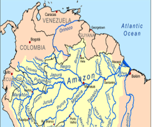
Figure 1: Amazon Basin
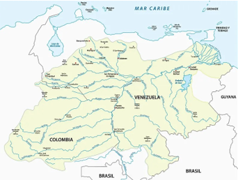
Figure 2: Orinoco Basin
However, Guyana's borders have not always been this way. For centuries Britain and Venezuela disputed the ownership of the territory. Then in 1897, Britain and Venezuela submitted their claims to a tribunal, consisting of jurors from different countries (Ministry of Foreign Affairs Guyana, 2021). Based on the tribunal’s decision on October 3, 1899, the mouth of the Orinoco River and the land on either side was granted to Venezuela, and Britain gained the land to the east stretching to the Essequibo River (United Nations, 2010).
The 1899 Arbitral Award was not just a victory for British Guiana, it was a defining moment. It established the colony's borders, paving the way for its eventual independence in 1966 (Ministry of Foreign Affairs Guyana, 2021).
Nevertheless, Essequibo is more than just boundaries. It comprises about 290,000 persons in 700 communities, 365 islands, numerous landforms, endemic wildlife, and most of Guyana’s minerals (Blossom Magazine, 2023). The Essequibo is everything west of the Essequibo River up to the border of Venezuela (Blossom Magazine, 2023).
What makes Essequibo so unique? The landforms and landscape, waterways, biodiversity, and resources link together to create an idyllic environment.
The area encompasses forested hills, and highlands, interior savannas, and a portion of the low coastal plain (Guyana Lands and Surveys Commission (GLSC), 2023). The highland and forested hills comprise multiple terraces and escarpments such as Ayanganna (6,700 feet); Erratic escarpments 1,000 to 3,000 feet with waterfalls like the Kaieteur lining the escarpments; Rough plateaus, 2000-3000 feet; and Flat-topped mesas with peaks (Smith, 1976). The Pakaraima Mountains rise to 8,000 feet above sea levell and Mount Roraima reaches to 9,219 feet along the Guyana- Brazil- Venezuela border (Smith, 1976). Vast savanna and lowlands interspersed with inselbergs are also prevalent in the interior (Smith, 1976). The coastal plain is narrow, below sea level, and is used mostly for large-scale rice farming (GLSC, 2023).
Furthermore, the highlands have streams and rivers with moderate gradients and rapids while the coast has rivers and lakes at low gradients with seasonally flooded swamps (Blossom Magazine, 2023; FEOW, 2019). The most notable are the Capoey, Mainstay, Hot and Cold, Tapakuma (see Fig. 3), and Mashabo lakes (Visit Guyana, 2020). Essequibo River rises in the Acarai Mountains and flows northwards through 1,014 kilometres of forest and savanna into the Atlantic Ocean (Britannica, 2023). Moist forests cover most of the region, with marsh forests along rivers and mangrove forests lining parts of the coast (Blossom Magazine, 2023; FEOW, 2019).
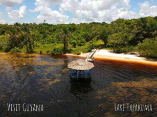
Figure 3: Lake Tapakuma (Visit Guyana, 2020)
Essequibo serves as an important biological corridor connected to the Amazon Basin (FEOW, 2019). As part of the Guiana Shield, Essequibo enjoys a rich biodiversity with more than 3500 fauna species and 6,500 flora species (Singh, 2022). Among the fauna, there are the Giant Anteater, the Black Caimans, the cunning Jaguar (see Fig. 4), and the Harpy Eagle (see Fig. 5) (Singh, 2022). There are over 900 bird species, 225 mammal species, 880 reptile species and approximately 60% of the forests are primary forests in Essequibo (Singh, 2022).
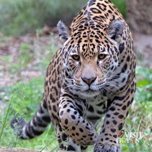
Figure 4: Jaguar (Singh, 2022)
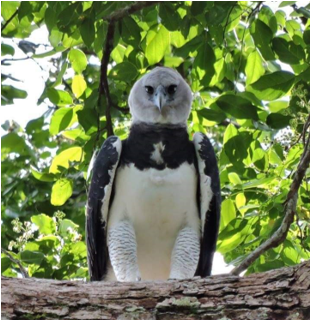
Figure 5: Harpy Eagle (Singh, 2022)
The County is furthermore home to protected areas like the Kaieteur National Park, the Iwokrama Forest, and the Kanuku Mountains Protected Areas (Fortune, 2023). These serve as sanctuaries for the diverse plant and animal life.
Essequibo is a geographic jewel; the immense potential of its natural resources is one reason why Venezuela has stirred up heated and occasionally threatening controversies (Ministry of Foreign Affairs Guyana, 2021). Hence it is important to delve into some of the most viable resources.
The main biological resource of Essequibo is the tropical rainforest hardwoods, especially the greenheart tree which makes timber for domestic use and exportation (Britannica, 2019). Considerable deposits of manganese also lie at Matthews Ridge in the northwest and diamond deposits are found in the Mazaruni River and other rivers of the Pakaraima Mountains (Britannica, 2019). Gold is situated in the subsurface and alluvial deposits. Other minerals include iron ore, copper, molybdenite, white sand, nickel, kaolin, uranium, and semi-precious stones (Britannica, 2019). Also, the liquid goldmine (oil) was discovered in 2015, 120 miles from Georgetown, and by the end of 2020 in the Stabroek Block. Guyana has an abundance of oil and is projected to yield 750,000 barrels of per day by 2025 (Britannica, 2019).
The numerous resources in Essequibo are therefore quite important to the economic growth and development of Guyana. Firstly, through the provision of forest products; the estimated export value of forest products was US $37.9 million in 2018 (Caribbean Development Bank (CDB), 2019). Guyana was voted the best ecotourism destination in the world in 2019 (Mattai, 2021) and ecotourism presently accounts for nearly 8% of the country’s Gross Domestic Product (Haar & Caus, 2023). Economic growth in Guyana increased to 4.5% in 2019, mainly due to the increased production of timber and gold (CDB, 2019). Guyana recorded a GDP growth of 43.48% in 2020 and 20.1% was recorded in 2021 (World Bank, 2023). Furthermore, oil production is slated to bring in US$1.63 billion in profit sharing and royalties by the end of 2023 (Haar & Caus, 2023). This revenue would allow for multisectoral investment that will improve education, healthcare, and the business and service sectors (Haar & Caus, 2023).
A stark contrast is seen when the aforementioned resource-fueled economic growth is juxtaposed with Venezuela’s economy. Essequibo's oil reserves offer a tempting prospect for Venezuela, hoping to revitalize its economy and regain its position as a major oil exporter; Venezuela seeks gold, diamond, and other minerals to diversify its resource base; and Venezuela, which faces increasing deforestation and environmental degradation views Essequibo's natural wealth as a potential solution (Ministry of Foreign Affair Guyana, 2023). More importantly, Essequibo's strategic location under Venezuela’s control would grant them access to the Atlantic Ocean, and bolster their trade and influence in the region (Ministry of Foreign Affairs Guyana, 2023).
Therefore the future of Essequibo depends on the resolution of the territorial dispute and the responsible management of all resources which are crucial to Guyana’s development.
For “Without the Essequibo, what would Guyana be? Without many mountains, without many sights to see, without many minerals to mine, without many adventures for me. Yes, without the Essequibo, what would Guyana be? Guyana won't be Guyana, native land to me.” (Ally, n.d.).
References
Ally, S. A. (n.d.). Poem- Without the Essequibo. Quizlet.com. Retrieved December 9, 2023, from https://quizlet.com/42475886/poem-without-the-essequibo-flash-cards/
Blossom Magazine. (2023, November 22). Essequibo – The Cinderella County – Guyana, South America. Guyanasouthamerica.gy. https://guyanasouthamerica.gy/places-across-guyana/essequibo-the-cinderella-county/
Britannica . (2019). Guyana - Economy . In Encyclopædia Britannica. https://www.britannica.com/place/Guyana/Economy
Britannica . (2023, December 8). Essequibo River | Guyana, Amazon, Wildlife. Www.britannica.com. https://www.britannica.com/place/Essequibo-River
Caribbean Development Bank. (2019). Guyana Economic Brief . Caribank.org. https://www.caribank.org/sites/default/files/publication-resources/CER%202019%20Guyana.pdf
Freshwater Ecoregions of the World. (2019). Essequibo . Feow.org. https://www.feow.org/ecoregions/details/310
Fortune , N. (2023, December 6). Essequibo’s biodiversity has been largely overlooked in the discourse. Stabroek News. https://www.stabroeknews.com/2023/12/06/opinion/letters/essequibos-biodiversity-has-been-largely-overlooked-in-the-discourse/
Griffith, I. (2021, April 12). For Guyana, retaining the resource-rich Essequibo region “is a life-or-death matter” - Ivelaw Griffith | OilNOW. Oilnow.gy . https://oilnow.gy/featured/for-guyana-retaining-the-resource-rich-essequibo-region-is-a-life-or-death-matter-ivelaw-griffith/
Guyana Lands and Surveys Commission . (2023). Natural Regions. Glsc.gov.gy . https://factpage.glsc.gov.gy/natural-regions/
Haar, J., & Caus, C. (2023, October 5). Beyond oil: Guyana’s emerging potential in ecotourism | OilNOW. Oilnow.gy https://oilnow.gy/featured/beyond-oil-guyanas-emerging-potential-in-ecotourism/
Mattai, I. (2021, March 17). Guyana: A Destination for Ecotourism. Passion Passport. https://passionpassport.com/guyana-ecotourism/
Ministry of Foreign Affairs Guyana. (2021). Statement on the commemoration of the arbitral award of October 3, 1899. STATEMENT ON THE COMMEMORATION OF THE ARBITRAL AWARD OF OCTOBER 3, 1899 | Ministry of Foreign Affairs. https://www.minfor.gov.gy/newsroom/statement-commemoration-arbitral-award-october-3-1899
Singh, R. (2022, March 18). Explore Essequibo| Giants. Www.facebook.com. https://www.facebook.com/groups/1653910321314304/permalink/5089084084463560/?mibextid=Nif5oz
Smith, C. L. (1976). Physiographic Sections of the Guiana Highlands, Venezuela and Guyana. https://apps.dtic.mil/sti/tr/pdf/ADA032466.pdf
United Nations - Office of Legal Affairs. (2010). Arbitral Award of 3 October 1899 (Guyana v Venezuela). Legal.un.org. https://legal.un.org/ola/
Visit Guyana. (2020, January 31). The five Great Lakes in Essequibo . M.facebook.com. https://m.facebook.com/gotoguyana/posts/the-five-great-lakes-in-essequibo-how-many-have-you-visited-guyana-greatlakes-vi/3004019199616813/
World Bank . (2023). GDP growth (annual %) - Guyana | Data. Data.worldbank.org. https://data.worldbank.org/indicator/NY.GDP.MKTP.KD.ZG?locations=GY
Geographical Awareness Week 2023
Author: Sarah Reid | Published: 13/11/2023
Geography Week 2023 is ringing in with the theme, “Embracing environmental sustainability as we innovate into the future of Geography”. This year we are illuminating the importance of sustainability and the linkage between environmental sustainability and geographical innovation.
Like many other fields, Geography is going through a major transition as a result of artificial intelligence (AI). This innovative technology is changing the way we investigate the environment and is creating new avenues for future development in research and application (Frąckiewicz, 2023).
Artificial intelligence (AI) can quickly and accurately sort out volumes of data. These algorithms are also being trained to identify features in satellite images, which helps Geographers to pinpoint environmental patterns. In addition, AI is being utilised to enhance geographical modeling, which forecasts future scenarios based on available data, like the effects of climate change (Frąckiewicz, 2023).
Technology has also made way for the development of environmentally sustainable innovations. The introduction of green architecture, carbon capture and storage, and recycled plastic road surfacing are three noteworthy examples. Green architecture (see figure 1) has distinctive planted walls and roofs that further minimise carbon emissions. Many also incorporate energy-efficient technologies like solar panels that lower energy usage (Studio Digiarch, 2023).
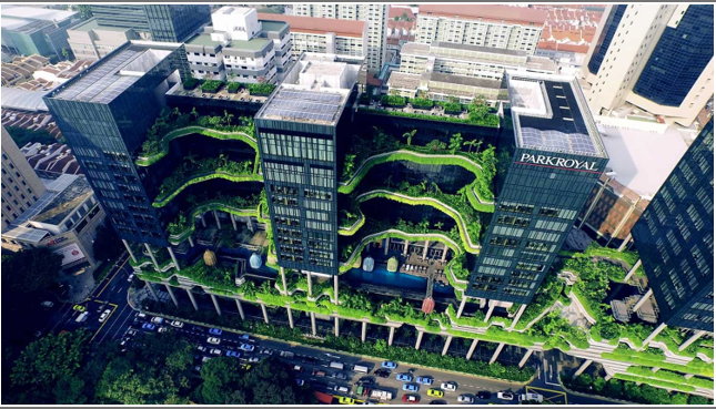
Fig. 1: Green Building with planted walls and solar panels (Campbell, 2020)
Engineers, builders, and architects can choose sustainable materials for green architecture with the help of AI. AI supports the use of recycled and renewable materials by assessing data on material sources and assisting in the making of environmentally responsible decisions (Gajbhiye, 2023).
To reduce the amount of carbon dioxide released from factories, carbon capture and storage technology is being implemented. The technology removes CO2 from the stream of emissions (Zohuri & Mcdaniel, 2021). Afterwhich the CO2 is permanently injected and stored underground. Technologies are being developed in countries like the United Kingdom, China, United States and Australia (Zohuri & Mcdaniel, 2021).
GIS applications can be used to model potential CO2 sources and sinks and estimate the dispersion of CO2 from a source into the atmosphere, which is an innovative approach to the future of geography (Yousefi-Sahzabi et al., 2011).
Recycled Plastic road surfacing helps to mitigate the impacts of climate change through the installation of hollow prefabricated roads (see figure 2) (Voight, 2021). These roads allow for the temporary storage of rainwater which prevents flooding. The water is slowly channeled underneath the roads which controls drainage and aids in droughts. It can be recycled up to 7 times, lasts longer and makes up to 72% less carbon emissions than regular roads (Voight, 2021). Geospatial technologies are used to monitor plastic material lifecycle and can be used in plastic recycling processes (Tran-Thanh et al., 2022).
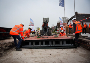
Fig. 2: Recycled Plastic Road installation in the Netherlands (Voight, 2021)
Taking all of this into account, Geography connects the dots between relationships among humans and the environment, and Geographers use this knowledge to manage natural resources and guarantee the planet's sustainability. This is not without the assistance of AI- enhanced GIS and remote sensing (Salem State University, 2019).
GIS with Artificial Intelligence is the hallmark of Geographical innovation and is considered to be a powerful green technology for the advancement of environmental sustainability. As Geographers, to ensure the security of our future, we must continue to embrace environmental sustainability as we innovate into the future of Geography.
GIS with Artificial Intelligence is the hallmark of Geographical innovation and is considered to be a powerful green technology for the advancement of environmental sustainability. As Geographers, to ensure the security of our future, we must continue to embrace environmental sustainability as we innovate into the future of Geography.
References
Campbell, T. (2020, November 20). Innovative Architecture: 10 Buildings that Redefine Sustainability. Artland Magazine. https://magazine.artland.com/innovative-architecture-ten-buildings-that-redefine-sustainability/
Chiancone, C. (2023, June 14). Leveraging Artificial Intelligence to Revolutionize Geographic Information Systems (GIS). Www.linkedin.com. https://www.linkedin.com/pulse/leveraging-artificial-intelligence-revolutionize-gis-chris-chiancone#:~:text=In%20the%20sphere%20of%20environmental
Frąckiewicz, M. (2023, August 26). The Future of Geography: How AI is Revolutionizing the Field. TS2 SPACE. https://ts2.space/en/the-future-of-geography-how-ai-is-revolutionizing-the-field/#:~:text=One%20of%20the%20most%20promising
Gajbhiye, A. (2023, October 6). Transforming India’s Sustainable Building Design with AI. Www.linkedin.com. https://www.linkedin.com/pulse/transforming-indias-sustainable-building-design-ai-avani-gajbhiye
Salem State University . (2019). Why Study Geography and Sustainability? | Salem State University. Www.salemstate.edu. https://www.salemstate.edu/academics/college-arts-and-sciences/geography-and-sustainability/why-study-geography-and-sustainability
Studio Digiarch. (2023, July 15). The Evolution of Green Architecture: Advancements and Innovations in Sustainable Building Design. Www.linkedin.com. https://www.linkedin.com/pulse/evolution-green-architecture-advancements-innovations-sustainable#:~:text=From%20the%20integration%20of%20solar
Tran-Thanh, D., Rinasti, A. N., Gunasekara, K., Chaksan, A., & Tsukiji, M. (2022). GIS and Remote Sensing-Based Approach for Monitoring and Assessment of Plastic Leakage and Pollution Reduction in the Lower Mekong River Basin. Sustainability, 14(13), 7879. https://doi.org/10.3390/su14137879
Voight, F. (2021, February 23). Recycled Plastic Roads Pave the Way to More Sustainable Infrastructure. Autodesk.com. https://www.autodesk.com/design-make/articles/plastic-roads
Yousefi-Sahzabi, A., Sasaki, K., Djamaluddin, I., Yousefi, H., & Sugai, Y. (2011). GIS modeling of CO2 emission sources and storage possibilities. Energy Procedia, 4, 2831–2838. https://doi.org/10.1016/j.egypro.2011.02.188
Zohuri, B., & Mcdaniel, P. J. (2021). Introduction to energy essentials : insight into nuclear, renewable, and non-renewable energies. Elsevier.
Sustainability Day
Author: Lalta Sugrim | Edited by: Sarah Reid | Published: 25/10/2023
As we continually utilise our natural resources, we must be cognizant of the possible effects on generations to come. The Malthusian Theory of Population suggests that population growth would be faster than that of our resources (food supply) leading to imbalances between the two. This would result in disasters such as famines, which could be managed in one of two ways (Agarwal, 2022):
The concept of Sustainable Development first appeared in the Brundtland Report in 1987, in which it defines Sustainable Development “as meeting the needs of the present without compromising the ability of future generations to meet their own needs” (Brundtland, 1987). The report highlighted social challenges that arose with development worldwide and how these challenges would transcend into the future. This is important because economic growth and societal well-being directly affect environmental health (Brundtland, 1987). In order to counter the economic, social, and environmental challenges, Sustainable Development emerged (Brundtland, 1987). As such there are three dimensions that are required to be in relative balance to ensure that there is a future (Brundtland, 1987).
They include:
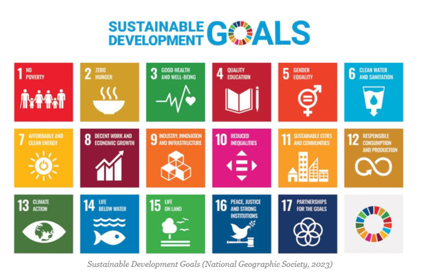
Sustainable Development emphasises that to create a society where everyone can thrive, today and tomorrow, requires the three dimensions: economic growth, protection of the environment and social inclusion, to be cohesive (Brundtland, 1987). To achieve this, resources must be used efficiently to ensure short and long-term benefits to people, economies and the environment. The Sustainable Development Goals (SDGs) guide the planning and execution of projects associated with Sustainable Development and were adopted by the United Nations in 2015 (Willsher, 2023). There are seventeen goals (See Fig 1). Generally, they provide a guide for the countries of the world to adapt strategies that promote the reduction of poverty and inequality and the improvement of health, education and economic growth – all while tackling climate change and preserving the forests and oceans (Horoszowski, 2015)
- Positive checks which are natural and human induced catastrophes that would correct the imbalance, including events such as natural disasters and wars (Agarwal, 2022).
- Preventative checks which are measures that can be taken to control population growth, including practices of celibacy and family planning (Agarwal, 2022).
The concept of Sustainable Development first appeared in the Brundtland Report in 1987, in which it defines Sustainable Development “as meeting the needs of the present without compromising the ability of future generations to meet their own needs” (Brundtland, 1987). The report highlighted social challenges that arose with development worldwide and how these challenges would transcend into the future. This is important because economic growth and societal well-being directly affect environmental health (Brundtland, 1987). In order to counter the economic, social, and environmental challenges, Sustainable Development emerged (Brundtland, 1987). As such there are three dimensions that are required to be in relative balance to ensure that there is a future (Brundtland, 1987).
They include:
- Economic growth – strategies on how to develop and promote economic well being
- Social inclusion – ensuring all peoples have equal opportunities
- Environmental protection – promoting conservation and preservation strategies for natural resources and biodiversity
Sustainable Development emphasises that to create a society where everyone can thrive, today and tomorrow, requires the three dimensions: economic growth, protection of the environment and social inclusion, to be cohesive (Brundtland, 1987). To achieve this, resources must be used efficiently to ensure short and long-term benefits to people, economies and the environment. The Sustainable Development Goals (SDGs) guide the planning and execution of projects associated with Sustainable Development and were adopted by the United Nations in 2015 (Willsher, 2023). There are seventeen goals (See Fig 1). Generally, they provide a guide for the countries of the world to adapt strategies that promote the reduction of poverty and inequality and the improvement of health, education and economic growth – all while tackling climate change and preserving the forests and oceans (Horoszowski, 2015)
In terms of the effectiveness of the SDGs, progress over the years was made in lowering income inequality, carbon emissions and hunger but it came to a halt in 2021 due to multiple armed conflicts. Improvements with health and education and the provision of basic services were also negatively impacted by COVID-19 and climate change. Although during COVID-19 subsequent progressions in ensuring healthy lives and well-being for all at all ages (SDG 3) made way for progress on sustainable cities and communities (SDG 11) (Eggenberger, 2022). Consequently, hospitals were created in underdeveloped communities like Bengaluru, India. Improvements were also reported in access to electricity, gender equality and sustainable forest management (Eggenberger, 2022).
However, significant advances are yet to be highlighted for all goals. But cooperation among government institutions and municipalities and the enactment and enforcement of policies would be a step in the right direction to achieve the goals and overall Sustainable Development by 2030 (Eggenberger, 2022)
In keeping with the Malthusian Trap, and the checks to prevent/manage it, Sustainable Development can be seen as a preventative check. It is a proactive way to preserve our future by making decisions and executing plans that ensure economic, social, and environmental viability in the present, however difficult they may be (Brundtland, 1987). Ultimately, in adopting Sustainable Development, and aiming for the 17 goals, we are considering the future generations, and we are nullifying negative outcomes with the use of technological innovations, resource management, population control, and environmental protection (UNDP, 2015). As Sustainable Development provides us with an agenda and means to manage our resources and population, it also gives us the opportunity to not be prey to Malthus’ Trap. So, on this World Sustainability Day, join us in making better choices on the policies we support, for the people we fight for, and for the place we call home, join us in securing a prosperous future.
References
Agarwal, P. (2022). Malthusian Theory Of Population - Intelligent Economist. Intelligent Economist. https://www.intelligenteconomist.com/malthusian-theory/
Brundtland, G. H. (1987). Report of the World Commission on Environment and Development: Our Common Future. United Nations. https://sustainabledevelopment.un.org/content/documents/5987our-common-future.pdf
Eggenberger, K. (2022, November 10). Has the UN reached its sustainable development goals? Yes and no. World Economic Forum. https://www.weforum.org/agenda/2022/11/the-un-sustainable-development-goals-a-positive-perspective/
Horoszowski, M. (2015, August 18). The Full List of the 17 United Nations Sustainable Development Goals. MovingWorlds Blog. https://blog.movingworlds.org/the-full-list-of-the-17-united-nations-sustainable-development-goals-with-pictures-sdgs/
National Geographic Society. (2023). Sustainable Development Goals. https://education.nationalgeographic.org/resource/sustainable-development-goals/
Sustainable Development Goals | United Nations Development Programme. (2015). UNDP. https://www.undp.org/sustainable-development-goals
Willsher, I. (2023, August 25). What Is Sustainable Development and Why Is It Necessary? Utopia. https://utopia.org/guide/what-is-sustainable-development-and-why-is-it-necessary/
World Rainforest Day
Author: Sarah Reid & Ariel Yong | Edited by: Pretima Lall | Published: 29/06/2023
World Rainforest Day was first celebrated on June 22, 2017. It was created by the 'Rainforest Partnership', an organisation that works with indigenous communities, businesses, and governments to protect rainforests. The day is a celebration of the importance of rainforests and an opportunity to raise awareness about the threats they face and to promote sustainable forest management. The theme for this year's World Rainforest Day is "Conserve. Restore. Regenerate." It encapsulates the collective efforts required to ensure the long-term thriving existence of rainforests (Vinodh, 2023).
World Rainforest Day aims to raise awareness about the importance of rainforests and encourage people to take action to protect them. Rainforests are home to a vast diversity of plant and animal life, and they play an important role in regulating the Earth and its climate. However, rainforests are threatened by deforestation, climate change, and other factors. By celebrating World Rainforest Day, we can help raise awareness about these threats and inspire people to protect rainforests.
Here are some ways to celebrate World Rainforest Day:
- Learn more about rainforests and the threats they face.
- Organise an event to raise awareness about rainforests.
- Plant a tree or volunteer your time to help protect rainforests.
- Support organisations that are working to protect rainforests.
- Make changes in your lifestyle to reduce your impact on rainforests.
In Guyana, many environmental organisations work assiduously to protect the rainforest. They engage stakeholders at all levels to ensure that Guyana's pristine and unexplored rainforest is conserved. Being part of the Guiana Shield, over 85% of Guyana's surface area is forested (World Bank, 2023). The Guiana Shield, which covers Guyana, Suriname, French Guiana, Brazil, Venezuela, and Colombia, is home to a vast diversity of plant and animal life. This area is made up of tropical rainforests, montane forests, and swamp forests (NASA - Earth Observatory, 2023).
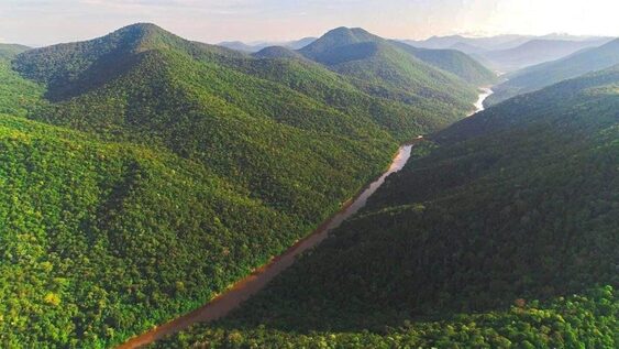
Tropical Montane Forest Landscape in Guyana (LCDS, 2023)
Rainforest Resources and Ecosystem Services in Guyana
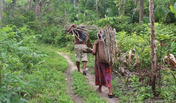
Rainforests supply 20% of oxygen and are large storehouses for carbon dioxide. Hence, they significantly reduce the effects of greenhouse gas emissions (National Geographic, 2023). They also help regulate temperatures by absorbing solar radiation. These processes altogether aid in stabilising the local climate (National Geographic, 2023). Rainforests house a vast number of plants and animals and produce nourishing rainfall by maintaining the hydro-ecological cycle. They protect against erosion and natural disasters (Butler, 2019). Moreover, they are a source of medicines, foods, fuel and timber and mineral products (Butler, 2019). Additionally, many indigenous people depend on the forest for their shelter, food, medicines and, in some cases, cultural practices (Butler, 2020). This shows that rainforests have environmental and socioeconomic value.
Indigenous Sustenance in Guyana's Forests (Mongabay, 2019)
Guyana's rainforests are characterised by exceptionally high levels of endemism. Four per cent of the world's plant and animal species are said to be present in the diverse topography (Lundt, 2022). Guyana's rainforest is home to thousands of tree species and about 8,000 species of plant life (Guyana - Nature and Wildlife, 2023). Birdlife is particularly abundant, with some 825 bird species recorded in the forest (Lundt, 2022). Birds include the harpy eagle and the more commonly spotted kingfisher and macaw. There have been over 300 freshwater fish and over 200 mammal species found. They include the jaguar, giant anteater, and giant otters (Guyana - Nature and Wildlife, 2023). The presence of the flora and fauna is critical for healthy ecosystem regulation.
Low Carbon Development Strategy
"The LCDS is a framework intended to map the path of a new growth trajectory in a non-polluting way. Tropical forest countries have long called for the ecosystem services provided by the world's standing tropical forests to be properly valued, through both public and private finance. This will enable people who live in forests and forest countries to create jobs and economic opportunity from an economy that works with nature, instead of today's reality where forests are often worth more dead than alive." — President of Guyana (2009).
This policy framework aims to have sustainable management of Guyana's forests through low-carbon initiatives geared towards protecting and managing forestry, biodiversity, water resources, climate adaptation and resilience and indigenous livelihoods (LCDS, 2023). This is being exercised through a market mechanism for forest climate services where Guyana takes advantage of its vast carbon sequestration capacity through carbon markets, where emitters of greenhouse gas emissions (for example, individuals or companies in the global north) compensate for their emissions by buying certified carbon credits to pay either for emissions reductions or sequestration (storage).
For many years, Guyana and most countries have advocated for including forest climate services in carbon markets. This is now part of the United Nations Framework Convention on Climate Change (UNFCCC) through a mechanism known as REDD+ (LCDS, 2023). This mechanism is being pursued in a phased approach, as shown.
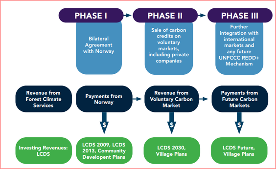
PHASED APPROACH TO GUYANA'S FOREST CLIMATE SERVICES AND LCDS (LCDS, 2023)
Phase I: The Guyana-Norway Agreement
In the absence of a UNFCCC REDD+ mechanism, Guyana and Norway sought to create a globally replicable model for a likely REDD+ mechanism. When it was agreed upon, the Guyana-Norway Agreement was the second-largest Interim REDD+ arrangement in the world. During the period 2009 to 2015, Guyana earned US$212.6 million dollars in payments for forest climate services from Norway, which reached US$220.8 million when investment income was included – the revenues were invested in renewable energy, protection against climate change, land titling, job creation and other priorities from the original LCDS.
In the absence of a UNFCCC REDD+ mechanism, Guyana and Norway sought to create a globally replicable model for a likely REDD+ mechanism. When it was agreed upon, the Guyana-Norway Agreement was the second-largest Interim REDD+ arrangement in the world. During the period 2009 to 2015, Guyana earned US$212.6 million dollars in payments for forest climate services from Norway, which reached US$220.8 million when investment income was included – the revenues were invested in renewable energy, protection against climate change, land titling, job creation and other priorities from the original LCDS.
Phase II: Moving to a Carbon Market Mechanism
While Phase Two will be influenced by both the UNFCCC and market development between now and 2025, Guyana anticipates that the post-2025 mechanism will incentivise all elements of REDD+, as this is the only way to provide the full suite of incentives for all the world's tropical forest countries. Therefore, Guyana's proposed forest carbon mechanism has four modules:
1. Reduce - to incentivise reducing deforestation
2. Restore - to incentivise restoring forests where deforestation has already taken place;
3. Conserve – to recognise the value that standing forests provide to the world by storing carbon sequestered over hundreds of years, in Guyana's case 19.5Gt of stored carbon;
4. Remove – to recognise the value that standing forests continue to provide by removing carbon dioxide from the atmosphere.
Together, these modules capture all elements of REDD+ - to provide incentives for all forest countries to move towards global reductions in deforestation and enhanced maintenance of standing forests.
Phase III: Earning Payments
Earning payments as Guyana moves towards a market mechanism will involve: (i) integrating with the market standard; (ii) generating credits in accordance with that standard; (iii) marketing Guyana's credits to potential buyers.
Revenues from market-based payments will finance LCDS activities identified within the LCDS, or activities related to the principles of the LCDS and its themes – and approved by the National Assembly via the National Budget process. The designated allocation of 15% of all earnings for Indigenous villages and forest-based communities, earned under a forest carbon financing mechanism, will be administered through a separate mechanism under the management of the Ministry of Finance and the advice of the MSSC.
See the lcds.gov.gy/wp-content/uploads/2021/10/LCDS-2030-Final-DRAFT-for-consultation-min.pdf for more information.
Guyana's forests hold a magnitude of resources and services that, if managed sustainably and transparently, can benefit the country's development for decades to come. As we observe World Rainforest Day 2023, let us be mindful of natural assets that are critical to our survival as we aim to Conserve, Restore and Regenerate our forests.
References
LCDS. (2023). Fact Sheet on Guyana's Engagement in ART TREES. Retrieved from https://lcds.gov.gy/fact-sheet-on-guyanas-engagement-in-art-trees/
Mongabay. (2019). 'The forest is our life': Hope for change in Guyana's forests (commentary). Retrieved from https://news.mongabay.com/2019/08/the-forest-is-our-life-hope-for-change-in-guyanas-forests-commentary/
NASA - Earth Observatory. (2023). Rainforest. Retrieved from https://earthobservatory.nasa.gov/biome/biorainforest.php#:~:text=The%20tropical%20rainforest%20is%20a,about%20250%20ft)%20or%20more
National Geographic Society. (2023). Amazon Rainforest Threats. Retrieved from www.nationalgeographic.org/encyclopedia/amazon-rainforest/threats/
Vinodh, N. (2023). World Rainforest Day 2023: Conserve, Restore, Regenerate for a Thriving Future. Retrieved from https://www.news18.com/lifestyle/world-rainforest-day-2023-conserve-restore-regenerate-for-a-thriving-future-8139121.html
Biodiversity Simply Put
Author: Lalta Sugrim | Edited by: Sarah Reid & Nirvana Persaud | Published: 04/06/2023
What is Biodiversity?
Biodiversity, simply put, represents the variations that life takes (Malhi et al., 2020), from the microscopic Streptococcus bacteria to the massive Blue Whale (See Figures 1 and 2) (The National Wildlife Federation, 2019). It has been estimated that there are some 8.7 million different species of organisms alive as of 2022, of which only 1.2 million have been identified and documented. However, it is estimated that there have been more than 5 billion distinct species of life on Earth throughout its history. This great variety of life on planet Earth is a direct result of the evolutionary processes occurring for the last 4 billion years (Malhi et al., 2020).

Figure 1: Streptococcus bacteria (Britannica, 2019)
|
Figure 2: Blue Whale (Henry, 2015)
|
Life can be found in almost every corner of our world, but some regions contain immense levels of biodiversity that are unparalleled in complexity and uniqueness. The tropical ecosystems (See Figure 3) between the Tropic of Cancer (23.5 degrees N latitude) and the Tropic of Capricorn (23.5 degrees S latitude) are the most biologically diverse ecosystems on the planet (The National Wildlife Federation, 2019; Malhi et al., 2020). This is due to an alignment of multiple factors, including the reception of more solar energy, which results in higher productivity and more food; less seasonal variability, which promotes niche specialisation; and the relative stability of the tropics when compared to the temperate regions in the past few millions of years (Brown, 2014).
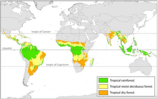
Figure 3: Tropical Forests between the Tropic of Cancer and Tropic of Capricorn (Koyama et al., 2019)
The Importance of a Biologically Diverse Planet
Our planet's relatively stable state is maintained by a number of processes. Biodiversity is one of the most important components that maintain life on Earth. It entails the relationships between and among various species in particular ecosystems and how they collectively thrive. The vast but complementary differences among species ensure the good health and security of ecosystems. This enhances the ecosystems' ability to carry out important services (Malhi et al., 2020).
Ecological services are often overlooked by the common folk. However, they make Earth habitable by aiding global climate stability, acting as a defence against certain natural disasters such as floods along coastlines and purifying our atmosphere and waters (The National Wildlife Federation, 2019). Furthermore, they aid in food provision since much of our food comes from pollinated crops. Pollinators such as bees aid in fertilisation and seed distribution. Invertebrates and other microorganisms maintain soil health which ensures healthy plants (Malhi et al., 2020; The National Wildlife Federation, 2019). As seen in Figure 4 below, ecological services can be divided into four (4) categories.
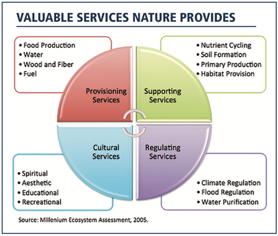
Figure 4: Ecological Services (Pruss, 2019)
The biological diversity of Earth is also crucial to humans. In addition to air, water, food, and climate, biodiversity has played a significant role in health care (Malhi et al., 2020; The National Wildlife Federation, 2019). Over the years, medicinal plants have been processed and used (See Figure 5). Garlic, for instance, aids in lowering blood pressure and treating Tuberculosis (Curtis, 2022). Continued research and development in this field will help us better understand the properties of different species that can be used to treat diseases (World Health Organization, 2015).

Figure 5: Examples of Medicinal plants (Curtis, 2022)
Biodiversity, in terms of genetics, is another crucially important factor that has contributed to the continued viability of life on Earth (The National Wildlife Federation, 2019). Higher genetic variability in an organism contributes to the differences in phenotypic and genotypic makeup of that organism to another. This further enables the organism to have a greater chance of survival in the face of environmental changes. Conversely, when a species' genetic variability is low, there is a higher chance of extinction and possible ecosystem collapse. For instance, if a disease infects a species with low genetic variability, the disease will spread rapidly and kill enough of the species before they can react to this change. Thus, low genetic variability can result in extinction. This low diversity may be the result of inbreeding, rapid change, or failure to adapt to said change (Minter et al., 2021).
Is the Earth's Biodiversity Changing?
The Earth's biodiversity has been changing since its creation, as extinction and evolution are natural parts of life. Historically, environmental changes (both natural and extra-terrestrial) have been the key drivers of such changes over prolonged or rapid periods, such as ice ages and meteor impacts (McDaniel et al., 2023). These events can trigger mass extinctions, drastically decreasing biodiversity and leading to profound ecological changes. However, after these dramatic drops in biodiversity, the species that survive will gradually fill the niches of those that perished (Hull, 2015). Furthermore, natural selection will favour the evolution of species that are smarter and more resilient. As such, mass extinction events are usually followed by rapid diversification (Hull, 2015). This can be seen after the Chicxulub impactor (See Figure 6) collided with Earth some 66 million years ago, ending the 180 million-year Age of the Dinosaurs and allowing for the rise and diversification of mammals – the Age of Mammals (Jaggard, 2019).
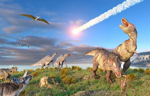
Figure 6: Impactor colliding with Earth (Spry, 2020)
In the last few centuries, there has been an unnatural change in Earth's biodiversity, primarily due to human activities, both inadvertently and intentionally. The most impactful activity has been the destruction and reconfiguration of natural habitats for alternative land uses such as agriculture, mining, and urban development (Malhi et al., 2020). This is due to an exponential growth in the global human population. In 1804 the population was 1 billion; it then doubled 123 years later in 1927; it then took only 33 years to reach 3 billion in 1960; as of 2022, the global population has surpassed 8 billion; and by the end of the century, 10.9 billion people are expected to be alive (See Figure 7) (Crowfoot, 2022; Malhi et al., 2020). This increase means more food, land, and resources are required for the population to survive, and consequently, biodiversity has been forced to pay the price. Approximately 50% of the global biodiversity decline is due to land use changes and overexploitation of natural resources (Malhi et al., 2020).
The rise of global temperatures and distortions in normal climatic conditions are evident. This indicates that climate change will be a stronger driver of biodiversity loss in the future (Malhi et al., 2020). Rapid changes in environmental conditions such as rainfall patterns, soil pH, atmospheric composition, nutrient cycling, ocean acidity, and extreme weather events will affect biodiversity and strain the abilities of species to cope with additional pressure from human activities. This has already resulted in an estimated 1,000,000 species being threatened with near extinction as human activities have accelerated the natural rate of extinction (IPBES, 2019).
The rise of global temperatures and distortions in normal climatic conditions are evident. This indicates that climate change will be a stronger driver of biodiversity loss in the future (Malhi et al., 2020). Rapid changes in environmental conditions such as rainfall patterns, soil pH, atmospheric composition, nutrient cycling, ocean acidity, and extreme weather events will affect biodiversity and strain the abilities of species to cope with additional pressure from human activities. This has already resulted in an estimated 1,000,000 species being threatened with near extinction as human activities have accelerated the natural rate of extinction (IPBES, 2019).
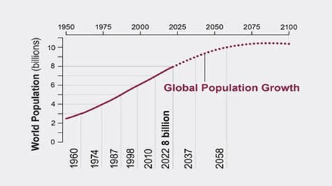
Figure 7: World Population Growth from the 1960s (Peek, 2022)
The Effects of Changing Biodiversity
As a result of the planet's declining biodiversity, nature has been pleading for help, sometimes in extreme ways. The effects of changing biodiversity can be felt in different Earth systems since they are all interconnected (Chapin III et al., 2000). The decline is impactful partly due to the sheer magnitude of destruction and modifications made to habitats by humans (See Figure 8) (Rafferty, 2023).
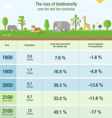
Figure 8: Rates of Biodiversity loss compared to Land- use conversion rates (IBERDROLA, 2022)
Biodiversity loss can have far-reaching consequences, such as ecological effects where the entire structure and functioning of an ecosystem are warped into lower productivity (Gotame, 2022). In addition, if too many species or critical species (like the honeybee) are removed, the entire ecosystem can become unstable and collapse (Gotame, 2022; Rafferty, 2023).
If the rate of biodiversity loss accelerates, we will lose vital ecosystems and the services they provide for our survival (Gotame, 2022). The decrease in genetic diversity can reduce crop productivity and ultimately affect food security which may further exacerbate mass hunger and malnutrition, especially in vulnerable populations. Biodiversity loss may also increase inequality within our societies and result in an economic downturn (Rafferty, 2023).
The importance of biodiversity and the effects of biodiversity loss are clear. Therefore, it is up to us to raise awareness about these issues, support conservation efforts, and adhere to biodiversity conservation and preservation policies. Simply put, it is our responsibility to take every possible step toward sustainability for the sake of all life.
References
The National Wildlife Federation (2019). Biodiversity. https://www.nwf.org/Educational-Resources/Wildlife-Guide/Understanding-Conservation/Biodiversity
Britannica. (2019). Streptococcus. Encyclopædia Britannica. https://www.britannica.com/science/Streptococcus
Brown J. H. (2014). Why are there so many species in the tropics?. Journal of Biogeography, 41(1), 8–22. https://doi.org/10.1111/jbi.12228
Chapin III, F. S., Zavaleta, E. S., Eviner, V. T., Naylor, R. L., Vitousek, P. M., Reynolds, H. L., Hooper, D. U., Lavorel, S., Sala, O. E., Hobbie, S. E., Mack, M. C., & Díaz, S. (2000). Consequences of changing biodiversity. Nature, 405(6783), 234–242. https://doi.org/10.1038/35012241
Crowfoot, T. (2022). World population just passed 8 billion: what you need to know. World Economic Forum. https://www.weforum.org/agenda/2022/11/world-population-passes-8-billion-what-you-need-to-know/
Curtis, L. (2022). 10 Healing Herbs with Medicine Benefits. Verywell Health. https://www.verywellhealth.com/healing-herbs-5180997
Gotame, B. (2022). The essence of biodiversity. The Kathmandu Post. https://kathmandupost.com/columns/2022/05/25/the-essence-of-biodiversity
Henry, L. (2015). Blue Whale. World Wildlife Fund. https://www.worldwildlife.org/species/blue-whale
Hull, P. (2015). Life in the Aftermath of Mass Extinctions. Current Biology, 25(19), R941–R952. https://doi.org/10.1016/j.cub.2015.08.053
IBERDROLA. (2022) Biodiversity loss, a risk for the environment and for humanity. IBERDROLA. https://www.iberdrola.com/sustainability/biodiversity-loss
IPBES (2019) Global assessment report on biodiversity and ecosystem services of the Intergovernmental Science-Policy Platform on Biodiversity and Ecosystem Services. E. S. Brondizio, J. Settele, S. Díaz, and H. T. Ngo (editors). IPBES secretariat, Bonn, Germany. 1148 pages. https://doi.org/10.5281/zenodo.3831673
Jaggard, V. (2019). Why did the dinosaurs go extinct? Science; National Geographic. https://www.nationalgeographic.com/science/article/dinosaur-extinction
Koyama, C. N., Watanabe, M., Hayashi, M., Ogawa, T., & Shimada, M. (2019). Mapping the spatial-temporal variability of tropical forests by ALOS-2 L-band SAR big data analysis. Remote Sensing of Environment, 233, 111372. https://doi.org/10.1016/j.rse.2019.111372
Malhi, Y., Balmford , A., Boyd , I., & Díaz , S. (2020). Key questions about biodiversity. The Royal Society. https://royalsociety.org/topics-policy/projects/biodiversity/introduction/
McDaniel, M., Teng, S., Sprout, E., Costa, H., Hall, H., Hunt, J., Boudreau, D., Ramroop, T., & Rutledge, K. (2023). Global Biodiversity (J. Evers, E. Editing, & K. West, Eds.). Education.nationalgeographic.org; National Geographic. https://education.nationalgeographic.org/resource/global-biodiversity/
Minter, M., Nielsen, E. S., Blyth, C., Bertola, L. D., Kantar, M. B., Morales, H. E., Orland, C., Segelbacher, G., & Leigh, D. M. (2021). What Is Genetic Diversity and Why Does it Matter? Frontiers for Young Minds, 9. https://doi.org/10.3389/frym.2021.656168
Peek, K. (2022). Global Population Growth Is Slowing Down. Here's One Reason Why. Scientific American. https://www.scientificamerican.com/article/global-population-growth-is-slowing-down-heres-one-reason-why/?amp=true
Pruss, S. (2019). Natural Capital and the Value of Ecological Services. FLOW. https://forloveofwater.org/natural-capital-and-the-value-of-ecological-services/
Rafferty, J. P. (2023). biodiversity loss. Encyclopedia Britannica. https://www.britannica.com/science/biodiversity-loss
Spry, J. (2020). New Simulation Reveals How Dino-Killing Asteroid Smacked Earth At The Perfect Extinction Angle. Syfy. https://www.syfy.com/syfy-wire/new-simulation-dino-killing-asteroid-ruined-earth
World Health Organization. (2015). Biodiversity and Health. Www.who.int. https://www.who.int/news-room/fact-sheets/detail/biodiversity-and-health
Climate Change
Author: Pretima Lall | Edited by: Nishida Persaud | Published: 31/03/2023
Introduction
Climate change refers to the long-term shifts in temperatures and weather patterns that occur naturally, such as through disparities in the solar cycle or anthropogenic causes, such as human activities. The former includes the sun's intensity, volcanic eruptions, and variations in the natural occurrence of greenhouse gas concentrations. The anthropogenic influence on greenhouse gas concentrations results from burning fossil fuels, deforestation, industrial processes that release gases, and changes in the reflectivity of the Earth's surface etc. These activities have contributed to the unprecedented increase in greenhouse gases following the Industrial Revolution, the primary cause of climate change. This paper discusses climate change, its natural and anthropogenic causes, and the impacts of climate change in Guyana. Finally, it highlights the Paris Agreement, which outlines a framework for nations to cooperate in addressing climate change.
What is Climate Change?
Climate change is a long-term shift in global temperatures and weather patterns, both natural and human-induced. The main driver of climate change since the Industrial Revolution has been human activity through the burning of fossil fuels like coal, oil, and gas. This process produces greenhouse gases, leading to the Greenhouse Effect and trapping heat in the Earth's atmosphere (United Nations, 2022). From the 1940s to 1970s, the planet experienced mass cooling due to post-war aerosol pollutants deflecting the sun's rays away from the Earth, which prevented atmospheric warming. Global warming began to increase in the 1980s, leading the Earth to its current state (History, 2017).
Natural Causes of Climate Change
Natural forces like the sun's intensity, volcanic eruptions, and changes in naturally occurring greenhouse gas concentrations had caused the Earth to go through warming and cooling phases in the past, long before humans were around. However, today's climatic warming, particularly since the mid-20th century, is happening at a much faster rate and cannot be explained by natural causes alone. NASA reports that "these natural causes are still in play today, but their influence is too small, or they occur too slowly to explain the rapid warming seen in recent decades" (Turrentine, 2021).
Anthropogenic Causes of Climate Change
The unprecedented increase in greenhouse gases following the Industrial Revolution is the leading anthropogenic cause of climate change. Carbon dioxide is the primary greenhouse gas, increasing by approximately 46% since preindustrial times. Burning fossil fuels is the primary source of human-generated emissions.
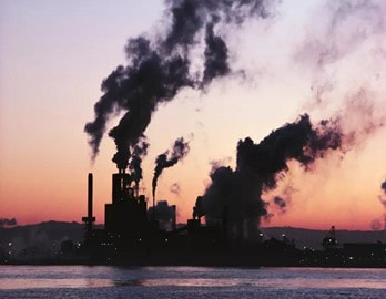
Figure 1: A waterfront factory pumping out clouds of smoke (NRDC, 2021)
Deforestation is the second major source, releasing stored carbon into the air. Forest degradation accounts for over 20% of global CO2 emissions. Other human activities that generate air pollution include fertilizer use, livestock production, and certain industrial processes that release fluorinated gases. Although forests and oceans absorb greenhouse gases through photosynthesis, these natural carbon sinks cannot keep up with rising emissions. Agriculture and road construction can also change the reflectivity of the Earth's surface, leading to local warming or cooling. The resulting buildup of greenhouse gases is causing alarming warming worldwide. The Earth's average temperature rose by approximately 1 degree Fahrenheit during the 20th century. When the last ice age ended 13,000 years ago, average temperatures were just 5 to 9 degrees cooler than now (NSF, 2010).
Impacts of Climate Change on Guyana
Climate change impacts are seen throughout every aspect of our world, including Guyana. Drought can harm food production and human health, while flooding can lead to disease spread and damage ecosystems and infrastructure. Climate change impacts are uneven across Guyana and the world, with underserved groups, who often have the highest exposure to hazards and the fewest resources to respond, being the most vulnerable. Water resource changes can significantly impact Guyana and our lives, with flooding becoming more frequent and drought becoming more common, particularly in coastal regions. Increased temperatures cause plants to lose more water, meaning farmers must give them more water, highlighting the ongoing problem of dwindling water supplies for Guyana's agriculture sector (The Guyana Standard, 2019).
Water
|
Changes to water resources can have a big impact on our world and our lives. Flooding is an increasing issue as our climate is changing. Compared to the beginning of the 20th century, there are both stronger and more frequent abnormally heavy precipitation events across Guyana. Conversely, drought is also becoming more common, particularly in coastal regions. Humans are using more water, especially for agriculture. This is an ongoing problem for Guyana’s agriculture sector (The Guyana Standard, 2019). |
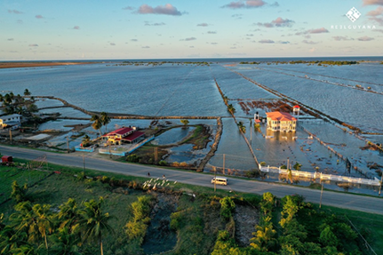
Figure 2: A section of Guyana’s coast following flash floods in 2021 (Reel Guyana, 2021)
|
Food Security
“Although farmers and researchers may be able to adapt some agricultural techniques and technologies or develop new ones, some changes will be difficult to manage. Our food supply depends on climate and weather conditions. Increased temperatures, drought and water stress, diseases, and weather extremes create challenges for the farmers and ranchers who put food on our tables. Human farm workers can suffer from heat-related health issues, like exhaustion, heatstroke, and heart attacks. Rising temperatures and heat stress can also harm livestock” (NOAA, 2021).
Population Health
Changes in weather and climate patterns can put lives at risk. Heat is one of the most deadly weather phenomena. Climate change is already impacting human health. As ocean temperatures rise, coastal storms are getting stronger and wetter, which can cause direct and indirect deaths. Dry conditions lead to more wildfires in forested areas, which bring many health risks to indigenous groups. Higher incidences of flooding can lead to the spread of waterborne diseases, injuries, and chemical hazards. As the geographic ranges of mosquitoes and ticks expand, they can carry diseases to new locations.
The most vulnerable groups, including children, the elderly, people with pre-existing health conditions, outdoor workers, and people with low income, are at an even higher risk because of the compounding factors of climate change. But public health groups can work with local communities to help people understand and build resilience to climate change health impacts (Balbus & Malina, 2009).
Infrastructure
Physical infrastructure includes bridges, roads, ports, electrical grids, broadband internet, and other parts of our transportation and communication systems. It is often designed for years or decades, and many communities have infrastructure created without future climate in mind (NOAA, 2021). But even newer infrastructures can be vulnerable to climate change.
Extreme weather events that bring heavy rains, floods, wind, snow, or temperature changes can stress existing structures and facilities. Sudden heavy rainfall can lead to flooding that shuts down highways and major business areas (NOAA, 2021). Increased temperatures require more indoor cooling, which can stress an energy grid.
The Environment
Climate change will continue to significantly impact ecosystems and organisms, though they are not impacted equally. Tropical ecosystems are some of the most vulnerable to the effects of climate change. Drivers such as sea-level rise induce erosion and coastal mangrove retreat. The increase in sea temperatures affects the survival of certain fish populations which humans depend upon for livelihoods. The ocean absorbs about 30% of the carbon dioxide released into the atmosphere from burning fossil fuels. As a result, the water is becoming more acidic, further affecting marine life (Griffith, 2022). The compounding effects of climate change are leading to many negative ecosystem changes.
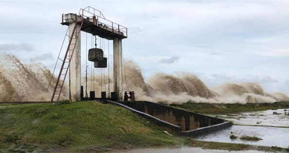
Figure 3: High spring tides, Coastal Overtopping (Loop News, 2019)
The Paris Agreement
The Paris Agreement is a legally binding international treaty on climate change. It was adopted by 196 Parties, including Guyana, at the UN Climate Change Conference (COP21) in Paris, France, on December 12, 2015. It entered force on November 4, 2016 (UN, 2021). This agreement seeks to:
● substantially reduce global greenhouse gas emissions to limit the global temperature increase in this century to 2 degrees Celsius while pursuing efforts to limit the increase even further to 1.5 degrees;
● review countries’ commitments every five years;
● provide financing to developing countries to mitigate climate change, strengthen resilience, and enhance their ability to adapt to climate impacts.
Guyana has revised and implemented policy frameworks in alignment with this agreement (among other climate change–related international policies) and benefits from local to international commitments. The National Climate Change Action Plan published in 2001 was revised to cater to continually changing climate trends regarding Guyana’s mitigation and adaptation strategies (FAO, 2023). Furthermore, the Low Carbon Development Strategy was revised in 2021 to update the management practices that presided over Guyana’s vast forest resources. This policy framework also provides carbon crediting, where Guyana benefits from carbon credits.
References
Balbus, J. M., & Malina, C. (2009). Identifying vulnerable subpopulations for climate change health effects in the United States. Journal of Occupational and Environmental
Medicine, 51(1), 33–37. https://doi.org/10.1097/JOM.0B013E318193E12E
FAO. (2023). Guyana Climate Change Action Plan in response to its commitments to the UNFCCC. | FAOLEX. https://www.fao.org/faolex/results/details/en/c/LEX-FAOC203119/
Griffith, I. (2022). Oil, Water, and Climate Change in the Guyana-Suriname Basin. https://theglobalamericans.org/2022/05/oil-water-and-climate-change-in-the-guyana-suriname-basin/
HISTORY. (2017). Climate Change History. https://www.history.com/topics/natural-disasters-and-environment/history-of-climate-change
Nations, U. (n.d.). What Is Climate Change? | United Nations. Retrieved March 20, 2023, from https://www.un.org/en/climatechange/what-is-climate-change
NOAA. (2021). Climate change impacts | National Oceanic and Atmospheric Administration. https://www.noaa.gov/education/resource-collections/climate/climate-change-impacts
NSF. (2010). Study Adds Clue to How Last Ice Age Ended |National Science Foundation. https://www.nsf.gov/news/news_summ.jsp?cntn_id=117576
The Guyana Standard. (2019). No developed lands available for flood-affected Region Five farmers – MMA/ADA GM | Guyana Standard. https://www.guyanastandard.com/2019/11/04/no-developed-lands-available-for-flood-affected-region-five-farmers-mma-ada-gm/
Turrentine, J. (2021). What Is Climate Change? https://www.nrdc.org/stories/what-climate-change#whatis
UN. (2021). The Paris Agreement | United Nations. https://www.un.org/en/climatechange/paris-agreement
United Nations. (2022). What Is Climate Change?. https://www.un.org/en/climatechange/what-is-climate-change
Careers in Geography
Author: Sarah Reid | Edited by: Gamaliel Mc Garrel | Published: 17/02/2023
What impact does climate change have on Small Island Developing States? How does globalisation affect our daily needs like energy and food supplies? These questions are being answered by Geographers who use a multidisciplinary approach to understand and respond to issues affecting the environment and humans. Human geographers analyse the spatial elements of human activities, whiles physical geographers examine, model, and forecast the patterns of natural features and processes. Others use tools and techniques like geographic information systems (GIS) to digitally integrate bio-physical and socioeconomic data (University of North Carolina, 2023).
Why do people choose to study Geography?
An individual may decide to study geography at a university because:
- They are concerned about global issues and have an appreciation for societies, economies and or the environment.
- They are interested in developing a range of skills and gaining practical experience with fieldwork and spatial science.
- They are seeking a broad-based academic degree with possibilities to specialise and diverse employment opportunities (Durham University, 2021); (Royal Geographical Society, n.d.).
Benefits of Studying Geography
Geography enables individuals to explore and comprehend space and place by recognising and investigating the vast differences in cultures, political systems, economies, landscapes, and environments worldwide. Geography also serves as an excellent framework for connecting areas of knowledge. It links with other natural and social sciences disciplines such as biology, data science, economics, environmental science, geology and politics. Hence students who pursue geography become better citizens; they understand local, national, and global issues more and participate in their resolution (Royal Geographical Society, n.d.).
Careers and Salary Rate
Can geography be a pathway to employment for those who wish to specialise or currently specialise in the discipline? The answer is “Yes,”. Contrary to popular belief, geography is not only for educators; numerous jobs can be derived from the discipline. What’s important to note is that many positions do not have a geography title. Teaching and research support the field with opportunities, especially at secondary and tertiary levels. At the university level, specialised teaching and research in all branches of geography have long been established, and geographically trained scholars are prominently associated with cartography, climate science, urban and environmental studies, locational economics, and other interdisciplinary programs (Bjelland et al., 2020).
Geographers who specialise in GIS, cartography, remote sensing and photogrammetry have access to an abundance of job opportunities. Their skills are highly required in atlases, map making, planning and environmental management. Physical geographers serve as natural resource analysts for water and minerals, etc.; weather and climate experts; soil scientists; and so on. And geographers who have specialised in environmental studies work in assessing the environmental impact of proposed development projects on air and water quality and endangered species.
Human and economic geographers collect and analyse transportation, population and economic development data. Numerous geography graduates also work as planners in private and governmental agencies concerned with community development and urban and regional planning. They map and examine land use plans and transportation networks, supervise urban land growth, and select suitable sites for public facilities (Bjelland et al., 2020).
Careers in geography can be broken down into eight geographic fields of concentration. They are:
- Geographic Education
- Geographic technology- Cartographer; GIS specialist for real estate agencies, utility companies, and local government; Remote-sensing analyst; Surveyor
- Physical Geography- Atmospheric Scientist; Climate Change Specialist; Coastal zone manager; Hydrologist; Soil conservationist; Agricultural extension agent
- Environmental Geography- Environmental manager or technician; Forestry Technician; Hazardous waste planner
- Cultural Geography- Community developer; Peace Corps volunteer;
- Planning- Urban and community planner; Transportation planner
- Regional Geography- Travel writer; Area specialist for central government
- Economic Geography- Site selection analyst; Real Estate agent; Economic development Researcher/ Analyst (Bjelland et al., 2020)
Geographers are in high demand in a world experiencing overpopulation, climate change, and other issues. So, the value of their work is reflected in their earnings. The most important determinant of salary is experience (Salaries in Guyana - Paylab.com, 2022). Usually, the more years of experience, the higher the salary, but the geographical location, education level and nature of the company or governmental organisation also play a role.
Below are popular geography jobs with the average monthly salary in Guyana (Average Salary in Guyana 2021, n.d.); (Salaries in Guyana - Paylab.com, 2022):
Below are popular geography jobs with the average monthly salary in Guyana (Average Salary in Guyana 2021, n.d.); (Salaries in Guyana - Paylab.com, 2022):
- Cartographer- $178,000
- GIS Specialist- $200,000
- Land Surveyor-$125,000
- Environmental Consultant/ Advisor- 200,000
- Meteorologist- $169,000
- Hydrologist- $150,000
- Forestry Officer- $118,000
- Urban/Community Development Manager - $200,000
- Real Estate Agent- $145,000
- Data Analyst– $154,000
With the growing importance of issues such as climate change, geography has arguably never been more relevant. Geographers are quite employable and earn competitive graduate salaries. Above everything, they are knowledgeable global citizens who use multidisciplinary approaches and skills to solve societal, economic and environmental problems. “Studying geography provides individuals with knowledge and transferable skills that will reward them personally and advance them professionally” (Royal Geographical Society, n.d.).
With the growing importance of issues such as climate change, geography has arguably never been more relevant. Geographers are quite employable and earn competitive graduate salaries. Above everything, they are knowledgeable global citizens who use multidisciplinary approaches and skills to solve societal, economic and environmental problems. “Studying geography provides individuals with knowledge and transferable skills that will reward them personally and advance them professionally” (Royal Geographical Society, n.d.).
References
Average Salary in Guyana 2021 - The Complete Guide. (n.d.). Salary Explorer. http://www.salaryexplorer.com/salary-survey.php?loc=93&loctype=1
Bjelland, M. D., Montello, D. R., & Getis, A. (2020). Human Geography: landscapes of human activity. Mcgraw Hill Education.
Career Guidance Charts. (2022). Blog Posts. Career Charts. https://www.careerguidancecharts.com/career-poster-blog/previous/2
Durnham University. (2021). 7 reasons why we study geography. Durnham University. https://www.durhamisc.com/blog/7-reasons-why-we-study-geography
Royal Geographical Society. (n.d.). Why you should study geography. RGS. https://www.rgs.org/geography/choose-geography/geography-at-university/#:~:text=Why%20study%20geography%3F
Salaries in Guyana - Paylab.com. (2022). Paylab - Salary Survey, Compare Salary, Salary Data. https://www.paylab.com/gy/salaries-in-country
University of North Carolina. (2023). What do geographers do? Department of Geography. https://geography.unc.edu/what-do-geographers-do/
National Geographic Day (27th January, 2023)
Author: Nishida. C. Persaud | Edited by: Trisson Harte | Published: 27/01/2023
What is National Geographic Day?
|
The National Geographic Society began its exploration of the Earth and its features in 1888. In order to progress towards a limitless future, they are currently guiding a new era of discovery that builds on their own illustrious past. The National Geographic community of explorers is advancing knowledge on a worldwide scale. As a result, people contribute to history in addition to science. This Society's goal is to shed light on and safeguard the world's natural beauty.
|
|
Earth's Physical Structure
The only planet known to maintain life is Earth. This rocky mass is the third planet from the sun, orbiting the star from an average distance of about ninety-three million miles. It is close enough to the sun to be warm but not so close that its surface is exposed to extreme heat and solar radiation. Approximately 4.5 billion years ago, the Earth's particles were left over from the creation of our sun; gravity eventually drew these particles together to form pebbles which then formed boulders and eventually the Earth. At its heart is a solid inner core covered by a liquid outer core. Surrounding the core is the mantle of varying viscosity- mostly solid but more liquid at plate boundaries and mantle plumes. The final layer of Earth is the crust. It is made of solid rock and represents approximately 1% of the Earth's mass.
The Internal Structure of the Earth
|
Earth's Energy Use
|
Earth's Position in the Solar System
Earth's unique position in the solar system allows it to house phenomena yet to be found anywhere else in the universe, particularly water and life. Because of Earth's unique distance from the sun, the planet is able to contain water and all other gases necessary for life. Moreover, the surface thereby has a cascading effect on the planet. It hydrates the land, helping create nutrient-rich soil. It collects and causes from oceans and freshwater systems and cycles upward to add moisture to the Earth's protective atmosphere.
Life on Earth
|
Where there is water, there is life. About 3.8 billion years ago, in the Earth's oceans, primitive life existed in the form of microbial organisms. Over billions of years, a range of more advanced life forms thrived on the Earth. Moreover, to harbour live births, biodiversity is expensive in nature. An estimated 1.5 million species of plants, animals, bacteria, fungi, and others have been catalogued, with potentially millions, if not billions, more yet to be discovered. |
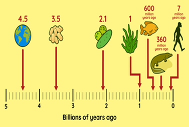
|
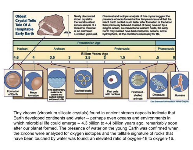
Happy Geography Awareness Week 2022!
Author: Pretima Lall and Sarah Reid | Edited by: Valenchia Forde | Published: 11/13/2022
'Advancing Geographical Knowledge, Strengthening Geo-thinkers'
Geographical knowledge helps us to explore and understand space and place - recognising the significant differences in cultures, political systems, economies, landscapes and environments across the world (RGS, 2022). It reinforces an understanding of the multiplicity and complementarity of issues in the human and physical systems. Issues, such as the astronavigation of medieval ships to that of modern-day aircraft using geospatial technology to planning settlements as the world's population continues to expand; geographical awareness has contributed significantly to human development. Owing to its integral role in human psycho-spatial development, there is a promising outlook for current and future development.
Geo-thinkers are crucial figures within the earth sciences who contribute to critical local, regional and international decision-making. Sustainable development goals that support climate action, clean water and sanitation, affordable and clean energy, sustainable cities and communities, life below water and life on land are greatly supported and informed by geo-literacy, encompassing many elements within geography (NatGeo, 2020) (United Nations, 2022).
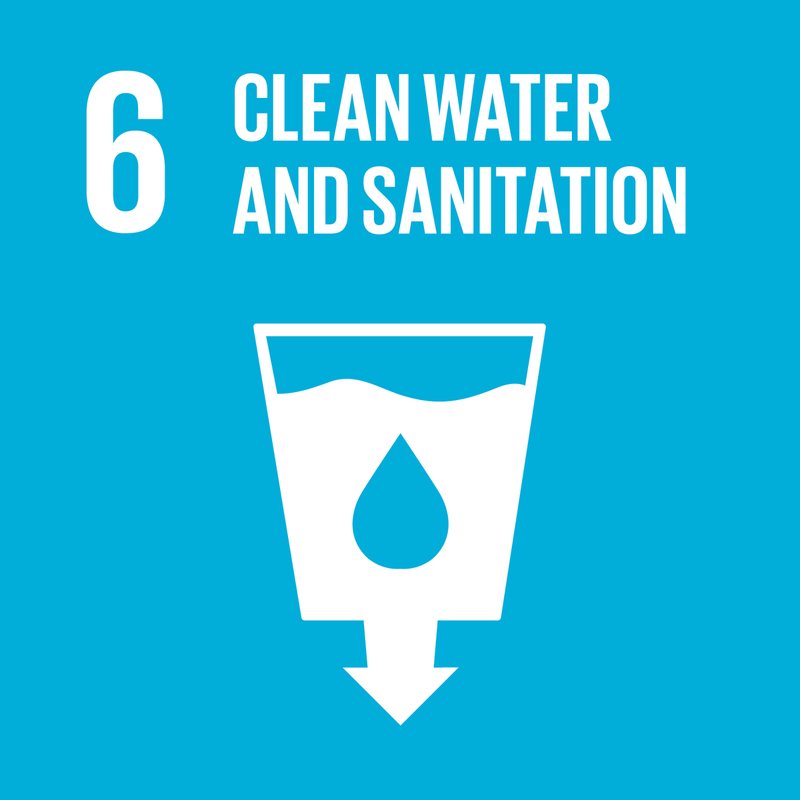
|
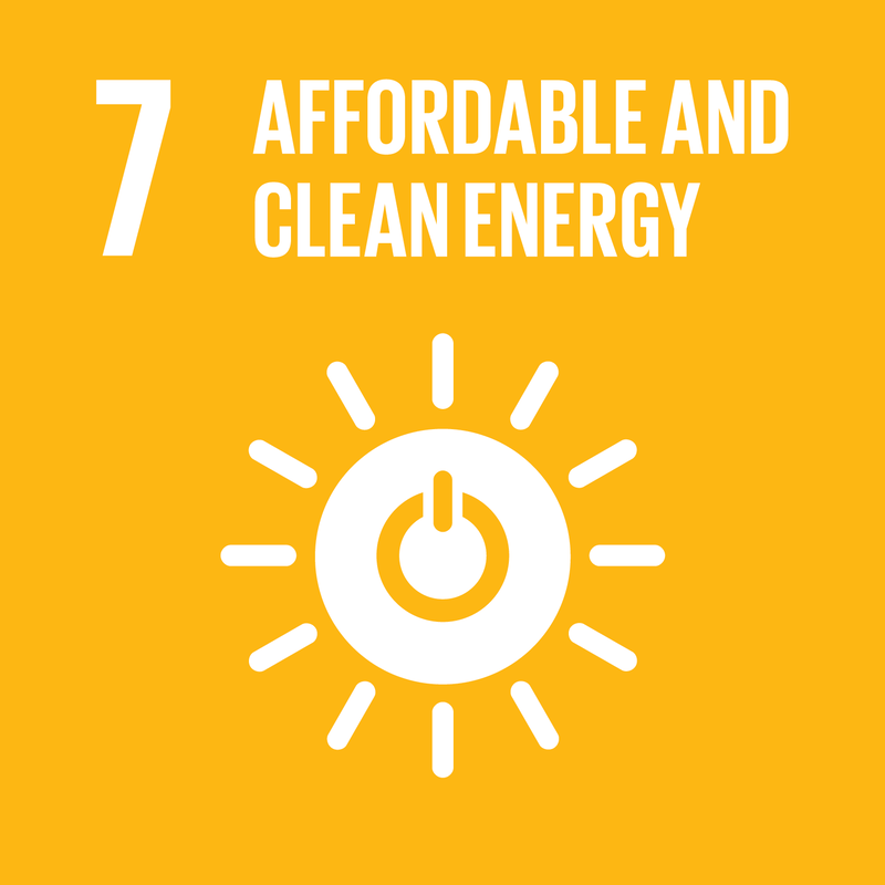
|
|
Geographical Contributions to Development
The physical and human aspects of geographical sciences are critical to development in the following areas; Technology, Telecommunications, Urban Development, Disaster Management, Healthcare, Renewable Energy and Land Administration.
Geospatial Technology
Geospatial technologies are modern tools that aid in geographic mapping and analysis of the Earth and human settlements. Geographical knowledge has been the backdrop for the evolution of these technologies, providing meaning and awareness to places and spaces. The first maps were drawn in prehistoric times, but aerial photography expanded them in the nineteenth century. Early cameras were launched into the sky on balloons, pigeons, and later aeroplanes in the twentieth century. Then, during WWII and the Cold War, it took on new dimensions with the introduction of satellites and computers. Satellites enabled images of the Earth's surface and human activities, and computers enabled the creation of maps and data sets on socioeconomic and environmental phenomena. In the last decade, these technologies have evolved and found new footing in areas such as medicine and crime analysis to find solutions to problems in the world (American Association for the Advancement of Science, 2019).
Geospatial technologies are modern tools that aid in geographic mapping and analysis of the Earth and human settlements. Geographical knowledge has been the backdrop for the evolution of these technologies, providing meaning and awareness to places and spaces. The first maps were drawn in prehistoric times, but aerial photography expanded them in the nineteenth century. Early cameras were launched into the sky on balloons, pigeons, and later aeroplanes in the twentieth century. Then, during WWII and the Cold War, it took on new dimensions with the introduction of satellites and computers. Satellites enabled images of the Earth's surface and human activities, and computers enabled the creation of maps and data sets on socioeconomic and environmental phenomena. In the last decade, these technologies have evolved and found new footing in areas such as medicine and crime analysis to find solutions to problems in the world (American Association for the Advancement of Science, 2019).
|
Urban Development
Geographical knowledge for urban development can be tied to urban geography. The emergence of urban geography can be traced back to the 19th century. In order to fully understand urban areas and how they evolve, a combination of elements within geography was applied. For instance, Physical geography was used to understand why a city is in a specific area. Cultural geography aided in understanding the people of a particular area, and economic geography helped urban planners to understand the types of economic activities and jobs available in an area. Overall, geographical knowledge was eminently positioned as a field that can enhance the understanding of city structure, form, and function and spur development (Briney, 2019). 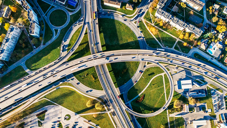
|
Telecommunications
Telecommunications allow for two-way information flows, and geographers have long been intrigued by its ability to fold space. Geographical interest in the study of communication can be traced back to the 1930s, but geographers began to measure and model the interactions between locations in the 1950s and 1960s. The accelerating flow of information between locations was explained in terms of "time-space convergence" and "human extensibility." Geographical knowledge- patterns and processes- helps shape communication systems, explain why different types of communication develop in different geographical areas and demonstrate how new technology enables the development of global communication (Donald, 1968;1973). 
|
Disaster Management
In the context of disaster management and natural hazards, geographical literacy also involves spatial thinking skills in identifying regions, the direction of evacuation in a disaster and having an awareness of broader ecosystems and environments. Historical data, current modelling and mapping technologies are employed in tracking natural hazards like hurricanes, floods and earthquakes and human-induced disasters like nuclear melt-downs and oil spills (Peijun, 2020).
In the context of disaster management and natural hazards, geographical literacy also involves spatial thinking skills in identifying regions, the direction of evacuation in a disaster and having an awareness of broader ecosystems and environments. Historical data, current modelling and mapping technologies are employed in tracking natural hazards like hurricanes, floods and earthquakes and human-induced disasters like nuclear melt-downs and oil spills (Peijun, 2020).
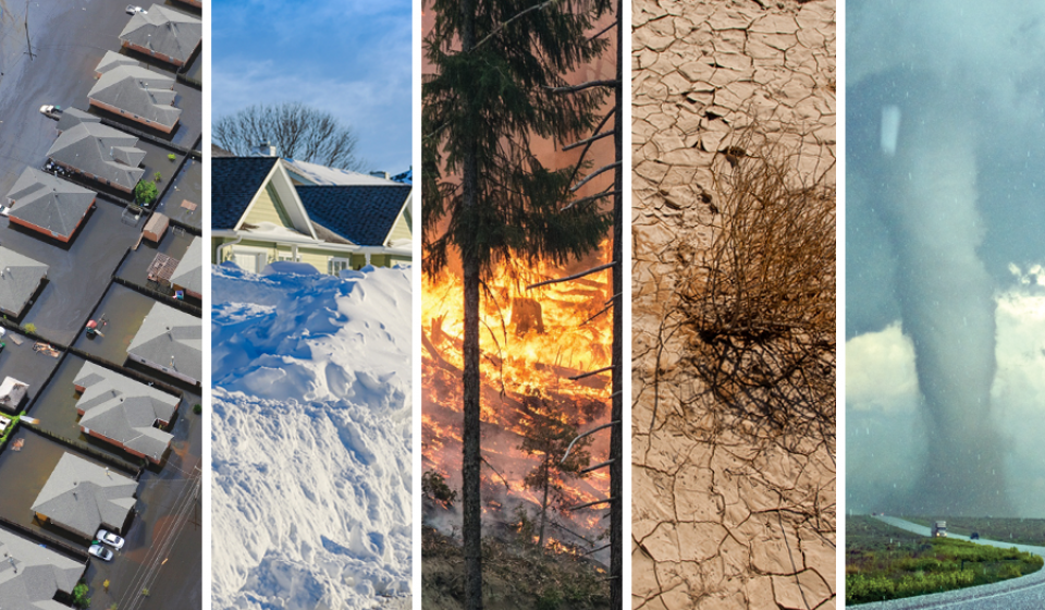
|
Health Care
Geography and health have a long conceptual and methodological history. Medical geographers focus on the interaction of health and geography and bring these two areas together. This focus on the geography of health and disease is multi-disciplinary because, for example, medical sociologists and social epidemiologists study people from an ecological perspective and engage health geographers in such studies. Spatial location (the geographic context of places and the connectedness between places) plays a significant role in shaping environmental risks and many other health effects. For example, locating healthcare facilities, targeting public health strategies, or monitoring disease outbreaks have a geographic context (Drummer, 2008). 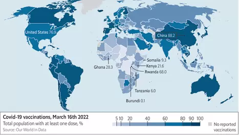
|
Renewable Energy
Energy use by human civilisation is studied in a geographical context, among others. This ties together the physical and human aspects of geography, which deals with the location of natural resources, climate-related effects and the distribution and demand of the human population. In developed and developing countries, geographic information systems are used (GIS) to improve renewable energy integration qualitatively and quantitatively by optimising resources and adapting to demand. By integrating geospatial technologies like satellites, we can determine where the potential for energy production is, whether the buildings or land are inhabited and determine a course of action that makes renewable energy production remarkably efficient (Bravo, 2019). 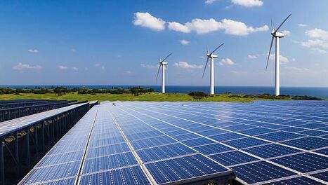
|
The Major Challenge for Geographical Advancement
New technologies have aided geographical advancement and understanding since the 19th century. But they have never been so rapidly transformative of the discipline as they are today. Hence geographical advancement in technology is not lagging. However, the lack of adequately trained personnel and the availability of finances needed to conduct research and development are two areas that pose a challenge in the short run.
Future of Geography and Geo-thinking
Large-scale computing power is now commonplace, and it is beginning to open new research opportunities in the field of geography. Large-scale simulation is becoming a way of life in physical geography. Web-based surveys and computing is slated to add a new dimension of flexibility to human geography; for instance, it will be possible to use computers extensively in the field to enhance ethnographic enquiry. Human geographers are now increasingly aware of spatial and temporal information previously overlooked (Thrift, 2002). This new paradigm that geography finds itself in is only the beginning of the discipline's rise as the world continues to combat its list of existential crises.
International Day for Biological Diversity 2022
Author: Pretima Lall and Christina Persaud | Edited by: Valenchia Forde | Published: 05/22/2022
Author: Pretima Lall and Christina Persaud | Edited by: Valenchia Forde | Published: 05/22/2022
'Building a shared future for all life'
The Value of Biodiversity
The United Nations has proclaimed May 22 ‘The International Day for Biological Diversity’ (IDB) to increase understanding and awareness of biodiversity issues (CBD, 2013). Biodiversity is essential for the processes that support all life on Earth, including humans. Without a wide range of animals, plants and microorganisms, we cannot have the healthy ecosystems that we rely on to provide us with the air we breathe and the food we eat. Biodiversity is also considered by many to have intrinsic value—that is, each species has a value and a right to exist, whether or not it is known to have value to humans (ASoF, 2016). Humans place 5 core values of biodiversity to them;
- Economic—biodiversity provides humans with raw materials for consumption and production. Many livelihoods, such as those of farmers, fishers and timber workers, are dependent on biodiversity.
- Ecological life support—biodiversity provides functioning ecosystems that supply oxygen, clean air and water, pollination of plants, pest control, wastewater treatment and many ecosystem services.
- Recreation—many recreational pursuits rely on our unique biodiversity, such as birdwatching, hiking, camping and fishing. Our tourism industry also depends on biodiversity.
- Cultural—many cultures are closely connected to biodiversity through the expression of identity, through spirituality and through aesthetic appreciation. Indigenous Australians have strong connections and obligations to biodiversity arising from spiritual beliefs about animals and plants.
- Scientific—biodiversity represents a wealth of systematic ecological data that help us to understand the natural world and its origins.
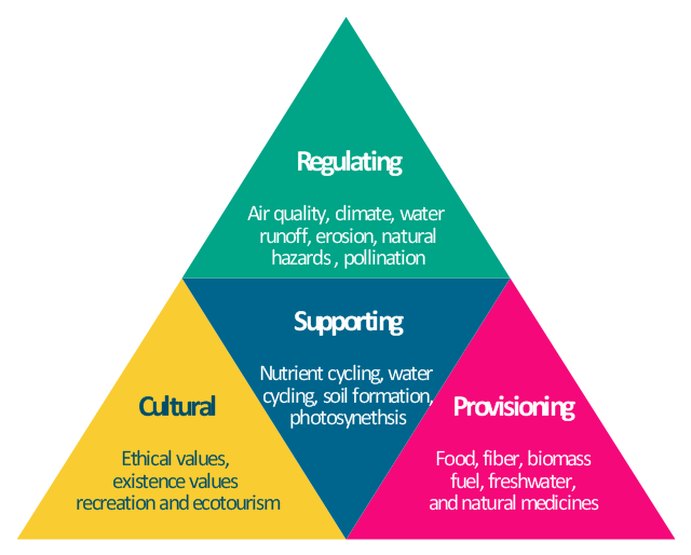
How do we measure biodiversity?
There is still much we do not know about the complexity of biodiversity on Earth. There are a number of ways that we measure it, with counting species the most common approach. So far, we have identified 1.6 million species but we do not know how many others there may be. It has been estimated that 84% of species may still be unidentified and with most species being rare, measurement can be difficult (JOVE, 2019).
Scientists use different sampling techniques, surveys or ways of counting depending on the organisms of interest. Technology ranges from a simple hand-held magnifying lens to images of whole landscapes captured by satellites and from sampling and sequencing traces of DNA in soil, water and snow to acoustic monitoring. There are also large-scale citizen science programs such as the Ocean Life Surveys, Red Siskin Count and Turtle Watch (Markham, 2010).
Scientists use different sampling techniques, surveys or ways of counting depending on the organisms of interest. Technology ranges from a simple hand-held magnifying lens to images of whole landscapes captured by satellites and from sampling and sequencing traces of DNA in soil, water and snow to acoustic monitoring. There are also large-scale citizen science programs such as the Ocean Life Surveys, Red Siskin Count and Turtle Watch (Markham, 2010).

Genetic Biodiversity

Endemic Species
|
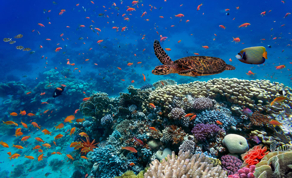
Ecosystem Biodiversity
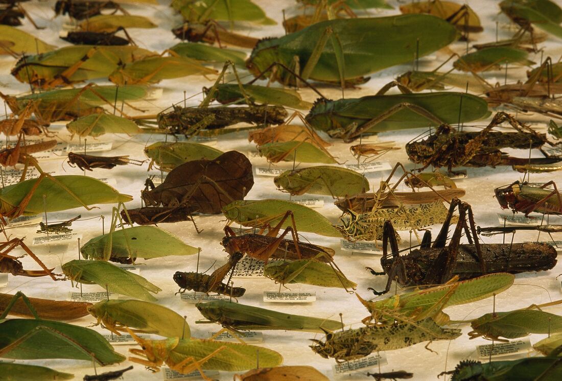
Species Richness
|
What is the scale of biodiversity loss?
The list of known recent extinctions is still a small fraction of all species on the planet but it is far above preindustrial levels and the evidence suggests that it is rising fast. A recent report indicated that one million species could be threatened with extinction. Since 1500, 1.6% of birds, 1.9% of mammals and 2.2% of amphibians have been recorded as extinct. Between 1990 and 2020, around 420 million hectares of forest (mainly tropical forest) has been lost and a further 10 million hectares, an area the size of Scotland and Wales combined, is being lost each year.
Extinctions have always occurred but the rate at which they are happening now far exceeds the rates at which species have naturally gone extinct over the course of the fossil record. The historical spread of humanity over the planet has been associated with waves of extinctions in other species. Key threats to date have been over-hunting and harvesting of species by people, habitat conversion and degradation, and the introduction of invasive species caused by human migration, settlement, trade, agriculture and resource extraction (Museum of Natural History, 2015).
Extinctions have always occurred but the rate at which they are happening now far exceeds the rates at which species have naturally gone extinct over the course of the fossil record. The historical spread of humanity over the planet has been associated with waves of extinctions in other species. Key threats to date have been over-hunting and harvesting of species by people, habitat conversion and degradation, and the introduction of invasive species caused by human migration, settlement, trade, agriculture and resource extraction (Museum of Natural History, 2015).
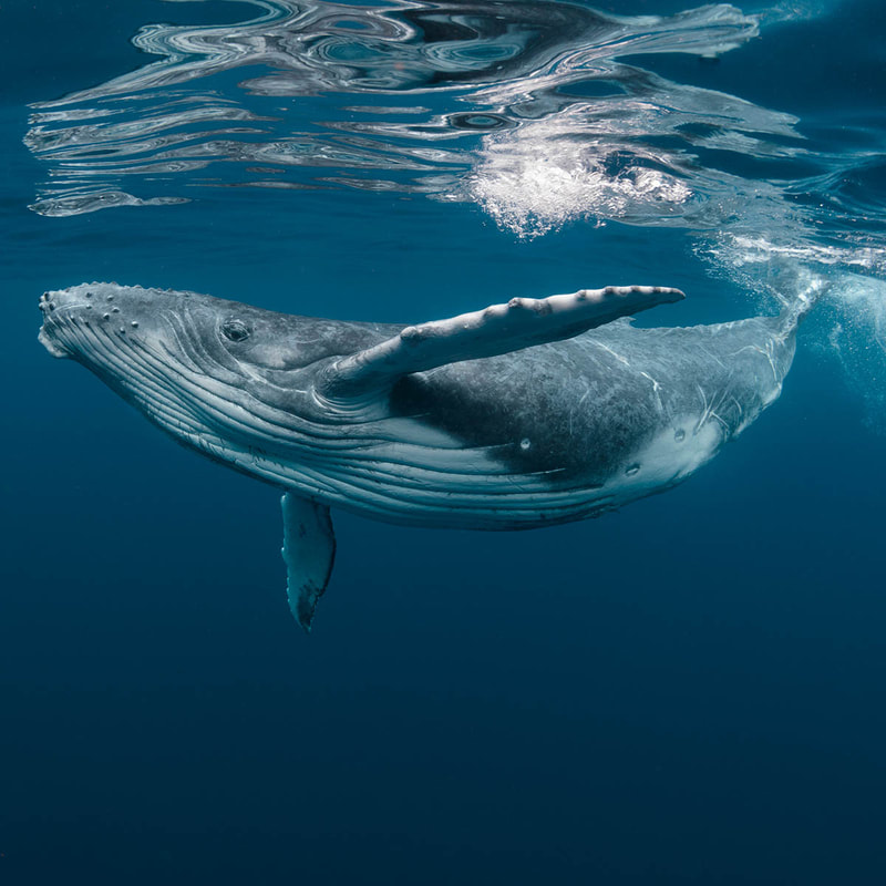
Blue Whale
Category: Endangered |
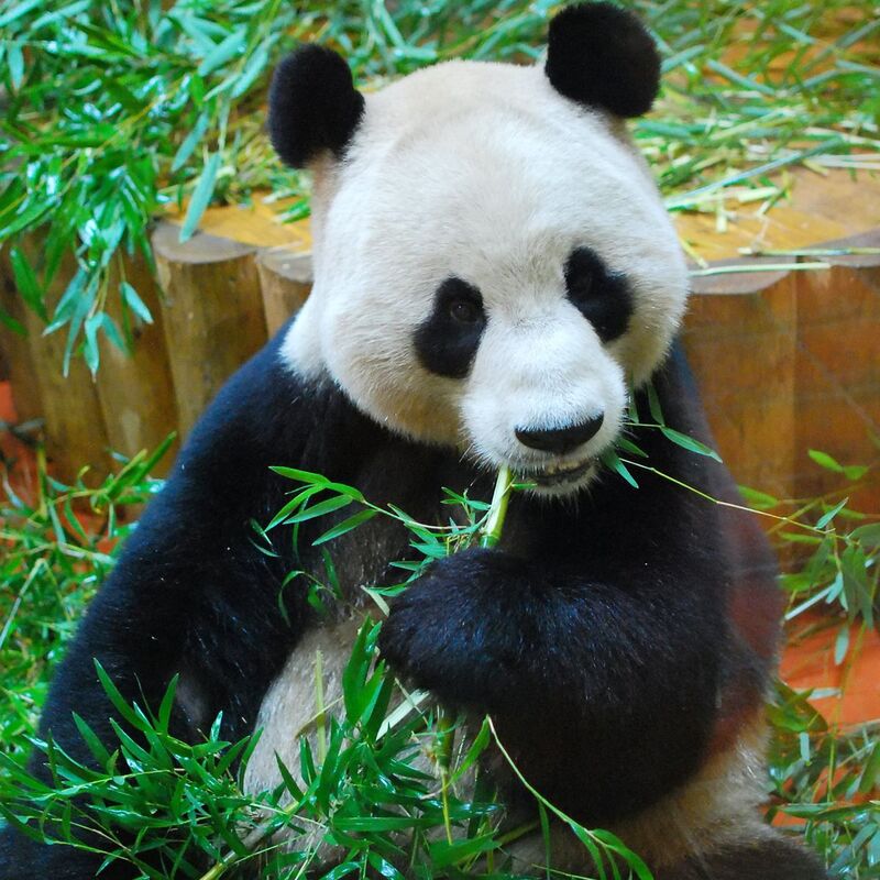
Giant Panda
Category: Vulnerable |

Greater Sage-Grouse
Category: Near Threatened |
Where is most biodiversity loss happening and why?
Biodiversity loss has been most pronounced on islands and in specific locations around the tropics, where distinctive species often evolve in isolation from the rest of the world. The introduction of alien species along with hunting and the clearing of vegetation by humans on small, isolated islands account for around 80% of known extinctions. Wider problems such as climate change, pollution, over-exploitation, and land use change - often to make way for agriculture - are causing biodiversity to decline in other areas such as in the oceans and rainforests. While much species loss has taken place in specific locations, it is often driven by global systems, with choices and actions taken in one place having effects far away (The Royal Society, 2020).
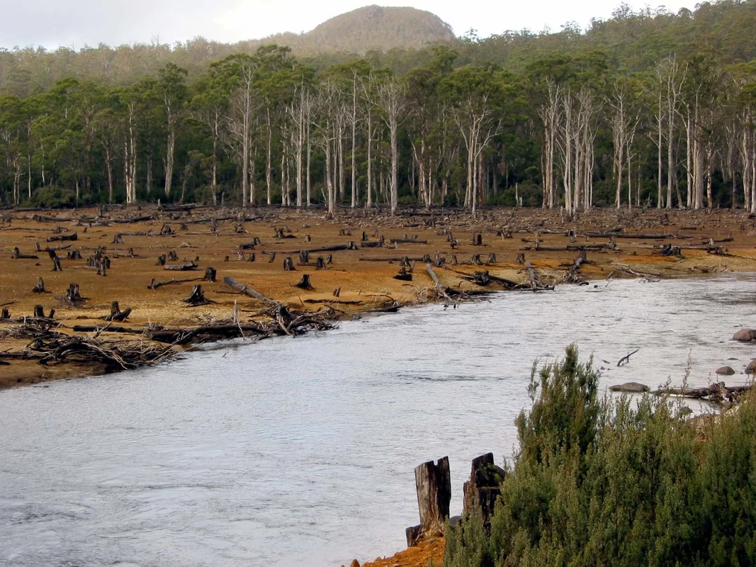
Deforestation can directly lead to biodiversity loss when animal species that live in the trees no longer have their habitat, cannot relocate, and therefore become extinct.
What can we do to protect biodiversity?
The theme for this year’s observance is “Building a shared future for all life”. Loss of natural habitats has been taking place over thousands of years, but scientists are confident that we have ways to help biodiversity recover. Global efforts so far have been insufficient. We must produce food much more efficiently using less land and with less waste. We must also change how and where we urbanize and industrialize landscape and the ocean, and how we produce energy. Paying more attention to the multiple values of nature, including placing a financial value on nature, might also help us to avoid losing more biodiversity (The Royal Society, 2020).
We can all build awareness on the vitality of Earth’s biodiversity by understanding and educating each other, following the Convention of Biological Biodiversity to gain insight on standing and arising issues and integrating ‘Green’ practices in our daily lives (Watson, 2021).
We can all build awareness on the vitality of Earth’s biodiversity by understanding and educating each other, following the Convention of Biological Biodiversity to gain insight on standing and arising issues and integrating ‘Green’ practices in our daily lives (Watson, 2021).
World Wetlands Day 2022
Author: Pretima Lall | Edited by: Valenchia Forde | Published: 02/14/2022
‘Wetlands Action for People and Nature’
What is World Wetlands Day and why is it celebrated?
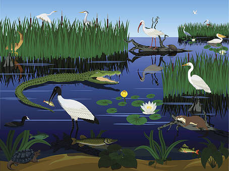
World Wetlands Day is celebrated each year on February 2 to raise awareness about wetlands. This day also marks the anniversary of the Ramsar Convention on Wetlands, which was adopted as an international treaty in 1971.
‘Wetlands Action for People and Nature’ is the 2022 theme highlighting the importance of actions to ensure the conservation and sustainable use of wetlands for human and planetary health. It is an appeal to invest financial, human and political capital to save the world’s wetlands from disappearing and to restore those we have degraded. Therefore, a call to take action for wetlands is the focus of this years’ campaign (Ramsar, 2022).
Nearly 90% of the world’s wetlands have been degraded since the 1700s and we are losing wetlands three times faster than forests. Yet, wetlands are critically important ecosystems that contribute to biodiversity, climate change mitigation and adaptation, freshwater availability, world economies and more (US-EPA, 2018). It is urgent that we raise national and global awareness about wetlands in order to reverse their rapid loss and encourage actions to conserve and restore them. World Wetlands Day is the ideal time to increase people’s understanding of these critically important ecosystems.
The Importance of Wetlands
Wetlands and Wild Life
Wetlands play an integral role in the ecology of watersheds. The combination of shallow water, high levels of nutrients and primary productivity is ideal for the development of organisms that form the base of the food web and feed many species of fish, amphibians, shellfish and insects. Many species of birds and mammals rely on wetlands for food, water and shelter, especially during migration and breeding.
Wetlands' microbes, plants and wildlife are part of global cycles for water, nitrogen and sulphur. Scientists now know that atmospheric maintenance is an additional wetland function. Wetlands store carbon within their plant communities and soil instead of releasing it to the atmosphere as carbon dioxide. Thus, wetlands help to moderate global climate conditions (WWT, 2019).
Wetlands' microbes, plants and wildlife are part of global cycles for water, nitrogen and sulphur. Scientists now know that atmospheric maintenance is an additional wetland function. Wetlands store carbon within their plant communities and soil instead of releasing it to the atmosphere as carbon dioxide. Thus, wetlands help to moderate global climate conditions (WWT, 2019).
|
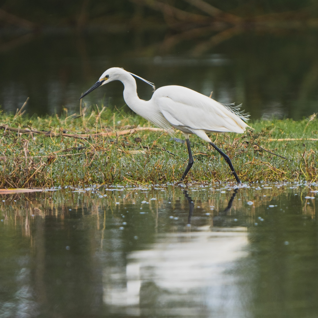
|
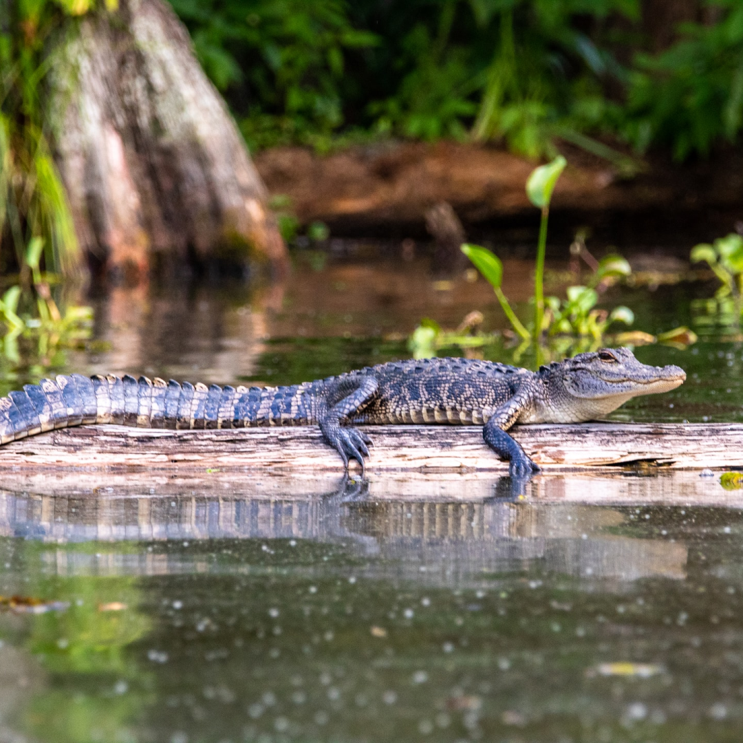
|
Wetlands and People
Far from being useless, disease-ridden places, wetlands provide values that no other ecosystem can. These include natural water quality improvement, flood protection, shoreline erosion control, opportunities for recreation and aesthetic appreciation and natural products for our use at no cost. Protecting wetlands can protect our safety and welfare (IWMI, 2014).
Wetlands can take many forms;
Wetlands can take many forms;
- Peatlands - wetlands with a thick water-logged soil layer made up of dead and decaying plant material. Peatlands include moors, bogs, mires, peat swamp forests and permafrost tundra (Wetlands International, 2018).
- Wetlands in deltas and along coasts are connectors between marine, freshwater and terrestrial ecosystems. These wetlands include mangrove forests, salt marshes, seagrass beds, mudflats and even coral reefs! (Wetlands International, 2018)
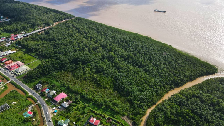
Mangrove forest along the Demerara River, Guyana (Thomas, 2021)
Examples of Wetlands
The Pantanal
Situated in the heart of South America, the Pantanal is the world’s largest tropical wetland. At 42 million acres, the Pantanal sprawls across three countries- Bolivia, Brazil, and Paraguay. While not as globally familiar as the Amazon to the north, the Pantanal is one of the most biologically rich environments on the planet with more than 4,700 plant and animal species (Greenpeace, 2020).
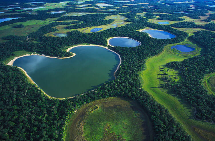
Aerial view of the world's largest wetland, Pantanal Wetland (Allofs, 2019)
The Everglades
In fact, the Pantanal contains South America’s highest concentration of some wildlife species, including the jaguar and caiman. From October to March, floodwaters fill the Pantanal like a giant reservoir and drain out slowly between April and September, providing ideal aquatic habitat, nutrient renewal, and flood control for millions of people downstream (Stonich, 2016). The Pantanal also contains a hub of economic activity, ranging from cattle ranching to soy production to tourism.
One of the most iconic wetlands in the United States is Everglades National Park in southern Florida. Named a UNESCO World Heritage Site, Everglades National Park has the Western Hemisphere’s largest stand of mangroves, an important and biologically diverse ecosystem. This vast subtropical wilderness of cypress swamps, mangrove forests, pineland, and hardwood hammocks is home to many endangered species, including West Indian manatees, American crocodiles, and Florida panthers (Huges, 2018). Although it is the third-largest national park in the contiguous U.S., only 20% of the original 100-mile-long Everglades watershed is included within the 1.5 million acres that currently make up the national park.
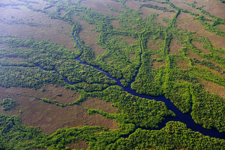
Florida’s Everglades National Park is the largest contiguous mangrove forest in the western hemisphere (Ward, 2019)
The Rupununi Wetlands - Guyana
Guyana is home to the Rupununi Wetlands - a unique and diverse ecosystem. These wetlands boast an unrivalled array of wildlife with over 1,400 species of animals. To understand why this area has such diverse wildlife we have to go back in time. Sixty-five million years ago, an extensive river called the Proto-Berbice-an extension of the Berbice river across the South-West of the Guiana Shield, carved a rift valley as it flowed through the entire region to the Atlantic (Simpson, 2021). Later when the land rose, the waters split with the eastern rivers flowing north to the Atlantic and the western rivers flowing south into the Amazon Basin.
To this day, the Rupununi wetlands continue to provide a link between the Amazon and the Essequibo waters, reflecting the ancient river 2.6 million years after it disappeared. During the rainy seasons, the region’s savannah and forests flood, allowing the waters of the Ireng and Rupununi rivers to merge forming wetlands allowing animals to move between them (WWF, 2017). For most of the year, the Rupununi wetlands shrink and the two rivers are separate leaving much of the savannah sun-baked and dry.
To this day, the Rupununi wetlands continue to provide a link between the Amazon and the Essequibo waters, reflecting the ancient river 2.6 million years after it disappeared. During the rainy seasons, the region’s savannah and forests flood, allowing the waters of the Ireng and Rupununi rivers to merge forming wetlands allowing animals to move between them (WWF, 2017). For most of the year, the Rupununi wetlands shrink and the two rivers are separate leaving much of the savannah sun-baked and dry.
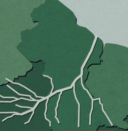
Imagery shows the Proto-Berbice River which connected the Essequibo and Amazon Basins 65 million years ago (Simpson, 2021).
|
Depiction of the mixing phenomena that occurs when the Rupununi and Ireng Rivers merge in the wet season (Simpson, 2021).
|
In the wet seasons, heavy rains from the Pakaraima and Kanuku mountain ranges cause the two rivers to burst their banks. The Ireng river floods toward the southeast of the savannah and flows back up the Pirara creek. Similarly, the Rupununi river rises and floods the Bonuni Creek north of the savannah and this creates a temporary lake, opening the historic portal between the two rivers. During the floods, fish such a giant Arapaima move out across the Rupununi wetlands to spawn (Simpson, 2021). At this time of plenty, the vast number of fish attract a rainbow of birds, Giant River Otters and Caiman. This is also an important time for local indigenous communities as they hunt and fish.
Additionally, the local economy is boosted as tourists are drawn to the mixing of wildlife from the Essequibo and wider Amazon basins. As the waters recede the fish and other wildlife travel back to the main rivers until the next annual spectacle. The Rupununi wetlands sustain the region’s rich wildlife and the livelihoods of the 8000 people who live there.
Additionally, the local economy is boosted as tourists are drawn to the mixing of wildlife from the Essequibo and wider Amazon basins. As the waters recede the fish and other wildlife travel back to the main rivers until the next annual spectacle. The Rupununi wetlands sustain the region’s rich wildlife and the livelihoods of the 8000 people who live there.
Jabiru Birds in the North Rupunini Wetlands, Guyana (Juliana Persaud)
|
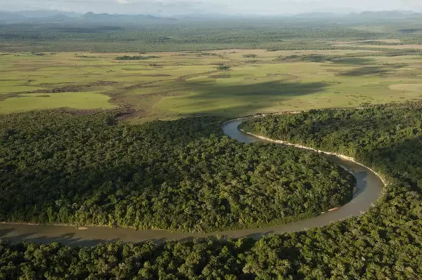
Rupununi River seasonally-flooded Savannah, North Rupununi, Guyana (Oxford, n.d.)
|
The Future of Wetlands
The rise of globalisation and growth of the world population pressures the resources provided by the natural environment. Wetlands are directly and indirectly affected by deforestation, mineral mining, infrastructure development, commercial agriculture etc. Recognising the global importance of wetlands and the scale of the challenges they face, calls for efforts in decision-making from the political and conservation arenas (Evans, 2018). Bolivia, Brazil, and Paraguay are participating in a transboundary effort called the Trinational Initiative for the Integrated and Sustainable Development of the Pantanal to conserve and sustainably develop the world’s largest tropical wetland (WWF, 2018). By developing initiatives and solutions like conventions and policies to the growing threats to wetlands, preservation of these vital ecosystems can ideally become critically heightened.
Happy Geography Awareness Week 2021!
Author: Pretima Lall | Edited by: Valenchia Forde | Published: 11/14/2021
Geo-Spatial Awareness for Sustainable Development
|
Geospatial Awareness
Geospatial Awareness helps us to reflect on the types of geospatial data, how much is available to us and how it is used in support of the various activities we engage in that affect our lives (Geonotics, 2021). Geospatial data is considered very important as it relates to the quality of decisions we make regarding the utilization of resources for the sustenance of human being and the sustainability of the environment (National Leadership Consortium, 2021).
|

|
In this technology-driven age, geospatial awareness is more than just technology-driven change. It is an opportunity for everyone to use various technologies to create an inclusive human-centered future. At the core of this revolution lies geospatial infrastructure (GeoSpatial World, 2021). This integrates data and information, old and modern technologies, people, processes, and social and organizational elements of the much larger digital infrastructure ecosystem, with ‘location’ as a common reference frame.
Sustainable Development
The United Nations defines Sustainable Development as ‘meeting the needs of the present without compromising the ability of future generations to meet their own needs (UNESCO, 2015). The growing human population and its demands on the earth's resources generate a need for sustainable practices. Sustainability as a concept recognizes that the environment is an exhaustible resource but care must be taken to conserve it. Therefore, it is important to use the environment and its resources rationally and protect it for the good of the Earth, our environment, humanity, and all living things.
Outside of the environment, sustainability can be explored in various other contexts, including economic development and social responsibility. GIS software allows users across the globe to share ideas on how to meet their resource needs, plan efficient land use, and protect the environment to guarantee the survival of future generations (ESRI, 2007).
Outside of the environment, sustainability can be explored in various other contexts, including economic development and social responsibility. GIS software allows users across the globe to share ideas on how to meet their resource needs, plan efficient land use, and protect the environment to guarantee the survival of future generations (ESRI, 2007).
How can Geospatial Tools drive Sustainable Development?
Modern tools that contribute to geographic mapping and analysis of the Earth and human societies include:
Remote Sensing: Used to capture imagery and data from space- or airborne camera and sensor platforms (Geocoding International, 2021).
|

Global Positioning System (GPS): This is a satellite-based radio-navigation system which gives precise coordinate locations to civilian and military users with proper receiving equipment [software, antennas and receiver/processors] (Federal Aviation Administration, 2004).
|
Geographic Information Systems (GIS): This is a suite of software tools for mapping and analyzing data that is georeferenced (assigned a specific location on the surface of the Earth, otherwise known as geospatial data) (Geocoding International, 2021).
|
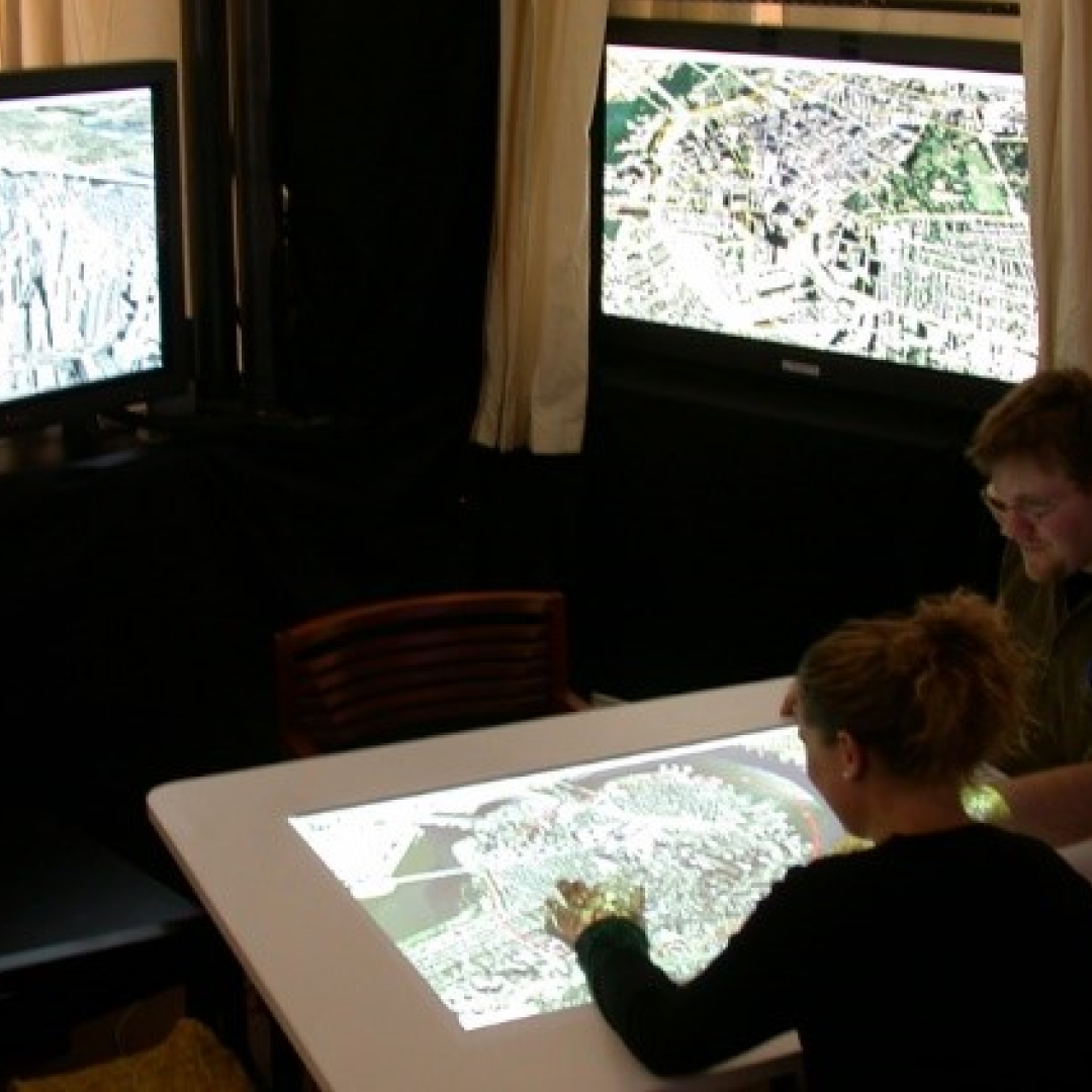
Internet Mapping Technologies: Include software programs, such as Google Earth and web features like Microsoft Virtual Earth, which are changing the way geospatial data is viewed and shared (Geocoding International, 2021).
|
Geo-Spatial Applications across Different Sectors
Telecommunication
The telecommunications sector is the backbone of all information and communication services provided through the internet, wireless sensors, phones, cables, and satellite networks. Geospatial technology and data facilitate and enable telecommunication network planning, risk management, and performance monitoring, thereby reshaping the telecom industry via digital modernization.
Urban Development and Smart Cities
Urban settlements today face increased agglomeration and need to self-sustain themselves. They are striving to become resilient and liveable by addressing heterogeneous conditions and unique challenges faced in the cities. Geospatial technologies and data and their applications are critical for sustainable urban development and the growth of smart cities. Geospatial technologies resolve growing urbanization challenges. This is done by aiding the development of accessible human settlements and the provision of resource-efficient infrastructure systems (GGIM, 2021).
Disaster Management
Geospatial technologies and tools play a pivotal role in the disaster management lifecycle as each disaster is georeferenced by a location. With the numbers of earthquakes, hurricanes, and storms rising globally, there is a need to incorporate geospatial technology use in disaster management workflows to enhance awareness of disasters. Geospatial technologies are critical for defining how disaster management agencies predict, measure, monitor, report, manage, mitigate, recover and rehabilitate cities, societies, and economies after a disaster.
Healthcare
The world is facing a health pandemic of an unparalleled scale. In a matter of months, COVID-19 has crippled the health, social and economic infrastructure globally. There is a need for a coordinated global approach by using technologies for early detection and response system for disease surveillance, chronic disease prevention, control of the spread of the pandemic, and immunization (HIT, 2021).
Geospatial tools allow for the mapping of the spread of infections over time, confirmed and active cases, deaths and recoveries, social vulnerabilities, biodata, and other aspects to help monitor at-risk groups and regions across the world.
Geospatial tools allow for the mapping of the spread of infections over time, confirmed and active cases, deaths and recoveries, social vulnerabilities, biodata, and other aspects to help monitor at-risk groups and regions across the world.
Renewable Energy
Despite climatic concerns, today, the world still depends on energy sources like crude oil, natural gas, and coal – resources that are expensive in the context of sustainability, exhaustible, and will get depleted in a few decades. As government organizations and policymakers emphasize the use of renewable energy as a preferred energy source going forward, geospatial technology has an important role to play in the process of renewable energy generation. Geospatial technologies help stakeholders responsible for renewable power generation to analyze and monitor processes while ensuring that the power generated is delivered efficiently.
Land Administration
Land administration covers all activities concerned with the management of land and its resources, both from an environmental and an economic perspective (Suzuki, 2014). Today, sustainable development demands effective land administration and management. Likewise, effective land administration and management support sustainable development. An enabling environment created through the development of policies, standards, and regulations leads to a data-creation and data-sharing environment for successful land administration (Hubner, 2000).
Geospatial Awareness for Sustainability of Everything
Society, economy, and the environment are fundamental determinants of sustainability, and technology innovation, particularly geospatial innovation, plays a defining role in building a sustainable and resilient world. Today, sustainability is consistently being redefined by environmentalists and societal champions, geographers, and economists. In this interconnected and interdependent ecosystem of sustainability, the value of geospatial technologies has often been ignored. However, technology and its innovations continue to be powerful forces in the evolving role of sustainability. Geospatial technologies bring with them a collaborative and coordinated approach, adding efficiency and effectiveness to sustainability programs (GGIM, 2021).
Happy Geography Awareness Week 2020!
Author: Valenchia Forde | Published: 11/15/2020
Learning Together as a Global Community

The world is essentially reduced to a village; an analogy coined as a result of Globalization. Globalization simply explains how economies, cultures and populations have garnered international influence and eventually operate on a global scale (Languages, 2020). This “global village” affords us a privilege that did not exist centuries ago. Among the factors that allowed for some positive developments in this regard are technological advancements and easy integration and trader of knowledge. From a more geographic standpoint and since Geography Awareness Week is being observed under the theme “Learning together as a global community”, it is important to understand the role Globalization plays in promoting the spread of geographical knowledge and ideas. Prehistoric humans identified changes in their environment and found ways to adapt to the changes. Why, What, When, How and Where are questions geographers ask today and may have been the questions that led humans throughout history to make observations and assumptions of the world they lived in an effort to better understand it.
Quite evidently, since prehistoric times, significant progress has been made in the discipline of Geography. Geography has been shaped and reshaped through the ideologies of Greek and Roman scholars and evolved into what we know today. With this came fundamental changes in the way we study the discipline. These changes include the application of new geographical research methods and techniques. It is our responsibility to learn beyond what we see.
Quite evidently, since prehistoric times, significant progress has been made in the discipline of Geography. Geography has been shaped and reshaped through the ideologies of Greek and Roman scholars and evolved into what we know today. With this came fundamental changes in the way we study the discipline. These changes include the application of new geographical research methods and techniques. It is our responsibility to learn beyond what we see.
What is Geoliteracy?
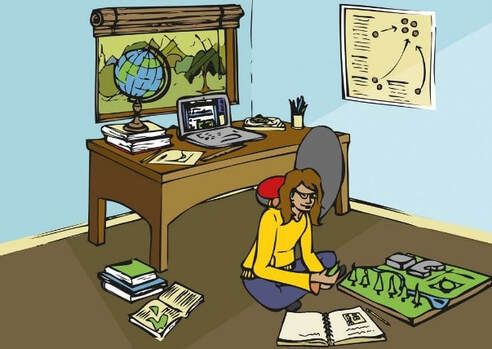
In our modern and globally interconnected world, it is more important now than ever before that we understand the world around us. Geo-literacy is a term adopted by National Geographic to describe how our world works. Geo-literacy is the ability to reason about Earth systems and interconnections to make far-reaching decisions (Geographic, n.d.). Almost any issue can be examined from a geographical perspective. Geo-literacy consists of three main components, namely, interactions, interconnections and implications (Geographic, n.d.).
Why is Geoliteracy important?
In the past, we may have wondered why implemented strategies for development in our local areas were quickly deteriorating or they did not correctly serve the purpose for which they were intended. Inefficient transport systems, poorly planned disaster mitigation strategies and construction of settlements in vulnerable areas are some of the results of failed strategies. Knowledge about place, space, site, and situation is a prerequisite for development to occur in a country. Being geo-literate helps the individual to make informed decisions about community and national development. Geo-literary enables planners and policymakers to steer away from choices that are likely to have negative consequences for people and the environment as well. It also provides the foundation for positive breakthroughs (Edelson, 2014). These include the development of early-warning systems for natural hazards, the introduction of low impact mining, and the introduction of high yield, and low impact agricultural practices, to name a few. Therefore, Geo-literary helps a long way in the sustainable management of natural resources, reduction in conflict, and promotion of more livable communities.
Advancing Global Geoliteracy: 2020 and beyond?
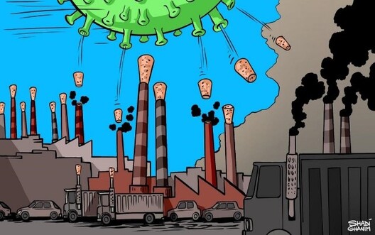
The year 2020 is best seen through its geographies and if it was not clear before, geographic knowledge is essential and relevant at this time. The world has witnessed widespread forest fires in Australia, summer floods in East African countries, and a global pandemic that radically altered humanity’s understanding of shared and separate spaces and the profound racial, social, and economic disparities of COVID-19. In these circumstances, geographical tools and practices are indispensable for helping individuals to better grasp what is happening and why (Geographers, 2020). The geographical response to these phenomena is widespread. For instance, Geographers continue to develop databases on COVID-19 and map, trace and measure climatic events among other aspects. The initiatives inform public policies and personal choices, as well as, support complex, relational perspectives and decision-making for a better future (Geographers, 2020). To support the initiatives, three components of geo education ought to be considered. These are:
- Interaction: To improve understanding of how the world works, we should increase and improve instruction on natural and human systems.
- Interconnection: To improve understanding of how the world is connected, we should increase instruction on historical, geographical, and social connections on local, regional, and global scales across all of the sciences, social studies, and humanities.
- Implication: To improve understanding of how to make well-reasoned decisions, we should add instruction on systematic decision-making to the curriculum, and we should provide students with opportunities to practice decision making in real-world contexts across the curriculum (Daniel C Edelson, 2014)
Secondary School Geography Exam Questions and Answers
Published: 07/13/2020
This document was compiled by a group of 8 students of the University of Guyana Geographical Society (UGGS) as a guide for upper-level Geography students who are preparing for final examinations. Some of the questions were extracted from the past CXC papers.
This study guide is organized under the following three main sections
- Map Reading;
- Natural Systems; and
- Human Systems.
Geography Week short report 2019
Published: 01/28/2020
Geography Awareness Week is a weeklong event geared towards getting people more involved in the geographical world around them. Geography Awareness Week began 25 years ago in 1989 and was indicated by National Geographic. Held in the third week of November, the event focuses on the interconnectivity of humans and the natural environment, to each other, and to the greater world we live in. Geography Awareness Week also connects students, community members, teachers, and others to members of the government and organizations who are working towards geographical awareness and getting people actively involved in the world they live in. Understanding how people relate to each other and the physical Earth is something that is currently lacking globally (GeographyRealm, 2014).
At a national level, geography is severely lacking in all aspects of Guyana. This issue becomes even more pressured as the world throws issues such as sustainable development and climate change adaption into the mix. Without, the integrated and multidisciplinary approaches founded in geography these issues will continue to plague our nation. Thus, simple questions such as the when, where, how and why would be left unanswered. The University of Guyana Geographical Society saw it fit to bring to the table the critical issues that are necessary for our drive forward. At present, this Geography Week activity stands as the first sample of a holistic view of the week and as such is a shining example of what to and not to do.
UGGS, under the leadership of Muzzammil Mohabir and the passion of Linda Johnson-Bhola, would have planned and executed the 5 activities. Being a massive, new and multi-talented feat, the society would have engaged its members from across the entire university. This resulted in one online article that was posted to the society website and was also forwarded to the social media platforms as well. The ‘On-Campus Geography Day’ was a grand event with many booths capturing the attention of the visitors. GIS Day is seen as the central activity of the week and was done in collaboration with many governmental organizations. Towards the end of the week, two (2) schools were visited and the society held a public awareness project at Giftland, where many individuals were engaged in discussions. These activities highlighted the efforts of UGGS and based on our success, GEOGRAPHY WEEK GUYANA is here to stay!
Happy Geography Awareness Week 2019!
Published: 01/28/2020
Think GEOGRAPHY: Develop Wisely!
Nature of Geography
The term 'Geography' was first coined by the Greek scholar Eratosthenes in the 3rd century AD, it is therefore not surprising that the term ‘Geography’ is Greek in origin. The prefix “Geo” means ‘relating to the earth’ while “Graphe” means ‘to write’. Geography is a discipline with a very longer genealogy. Man has always had a keen interest in knowing why, what, when, how, and where, about various phenomena and their interrelationships; these interests are geographical in nature. This has led to observations and assumptions of the physical world and its lithosphere, hydrosphere, atmosphere, and biosphere to help in the understanding of why and where things are the way they exist. Geography was further developed through exploration and mapping (Hussain 2007).
Geography is a field of science that focuses on the physical environment and human interaction. Therefore, the aim of discipline is to ‘study the origin of phenomena, the processes that influence their changes and the spatial extent of such changes’ (Hussain 2007).
Geographers seek to answer several key spatial questions. These include: how and why things are distributed or arranged in a particular way on Earth’s surface. They ask questions about how the interaction of different natural and human activities on the Earth’s surface shapes the world in which we live; how things that are located in the same or distant places change over time; and why places develop and change in particular ways. These questions are at the heart of the “geographic perspective” (National Geographic, n.d).
Careers in Geography
If you want to make a difference in the world, studying geography is a great way to start! Careers in Geography offer various opportunities to recognize contemporary spatial issues and to develop solutions. Some of the more pressing contemporary issues include climate change, natural hazards and disasters, land use, overpopulation, and urban expansion. Some of the careers in Geography are:

Cartographers- These persons specialize in the production of maps. They also produce charts, spreadsheets, and travel guides. Cartographers work in many government agencies, surveying and conservation organizations.
|

Town & Country Planners- are responsible for the management and development of towns and cities. They use their knowledge and analytical skills to improve existing infrastructure and to find solutions to environmental issues that affect settlement and livelihood activities.
|
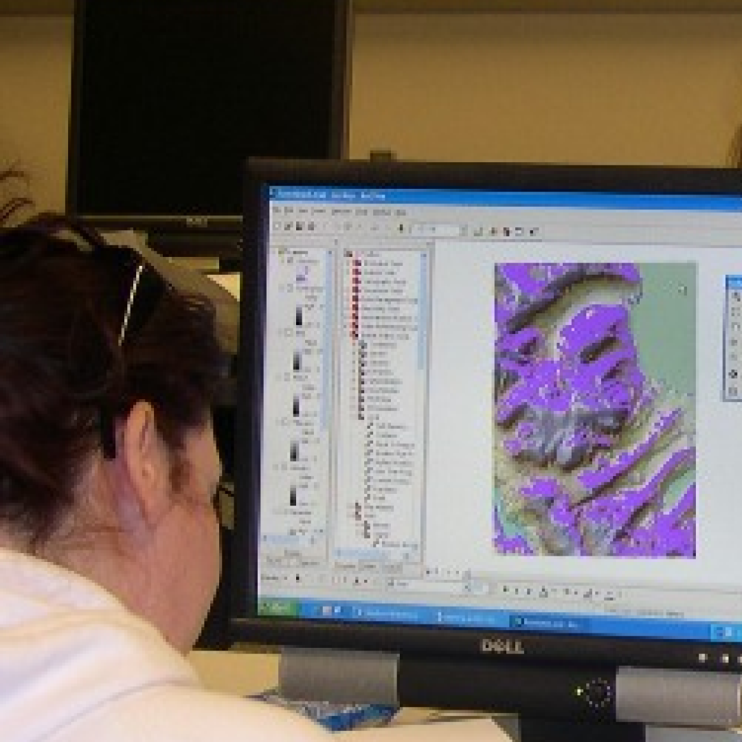
Geographical Information Officers - gather and analyze spatial data using Geographic information systems (GIS). This tool can be applied to all disciplines/fields, including medical, military, forestry, agriculture, geology, meteorology, urban planning, regional planning, municipal management, transportation development, and telecommunications.
|
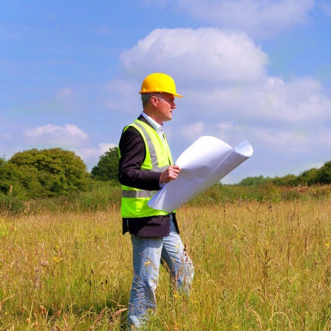
Environmental Consultants - ensure that both the clients of government and private sectors comply with regulations. They also help to address environmental issues.
|
Importance of Geography to National Development

Did you know that Geography can help us to solve our national development issues? Geography allows us to critically assess and analyze environmental and socio-economic problems (such as climate change, deforestation, pollution, settlement, conflict over land and resource use) and to devise solutions through the application of knowledge, skills, and technology. It is through these avenues that we are able to plan better for future developments (Gress 2006).
Knowledge the science is important since it helps to create awareness in cultural diversity. This is important to our leaders in the fields of politics, economics, health and the military since Geography offers pathways to understand the differences in the language, religion, and tradition of various groups of people.
Knowledge the science is important since it helps to create awareness in cultural diversity. This is important to our leaders in the fields of politics, economics, health and the military since Geography offers pathways to understand the differences in the language, religion, and tradition of various groups of people.
How can Geography aid in the Development of Guyana?
Professionals in Geography can engage in a plethora of initiatives, including the following:
- Develop community-based and regional planning strategies, plans, and programmes; and
- Research to inform integrated development and prioritize areas for development especially for bridging the gap between coastal and hinterland areas and eliminating the inter-regional and intra-regional differences in the country.
Guardians of the Earth Climate Rally
Published: 10/15/2019
|
|
The Climate Rally was a collaboration between the University of Guyana Geographical Society, UG Female Empowerment Movement and Policy Forum Guyana and took place on the 29th of September. The rally came under the larger 'GLOBAL CLIMATE STRIKE' made possible by Ms. Greta Thunberg .
The event involved a march from the Bank of Guyana to the Kingston Band Stand, thereafter there were short talks and cultural events that were aimed to engage and educate the participants. Some attendees included Namilco, GIT, Marion Academy, Bishop High School among others. Approximately 500 persons took part and the event required 50 odd volunteers to make it a complete happen. In the end, the event was a complete success.
Special thanks to all our sponsors and volunteers.
|
|
River Guardian Project Report
Published: 10/15/2019
Duration of project: May -June 2019
The Vice President along with a few representatives of the Geographical Society attended a meeting which was conducted by Policy Forum Guyana. At the meeting, the members of the Geographical Society volunteered to carry out a River Guardian pilot project proposed by Policy Forum Guyana. This River Guardian pilot project was done in seven randomly selected schools in Georgetown, whereby the 6th-grade students were taught lessons on Freshwater. This project was started in June 2019 and ended in the first week of July 2019. The Schools identified were: Montrose, Lusignan, LBI, BV, Eccles, Plaisance and St Andrews.
The lessons taught were:
Lesson 1- Types of water and freshwater regions
Lesson 2- Freshwater animals/species and importance of freshwater
Lesson 3- Anthropogenic and natural impacts on freshwater
Lesson 4- The importance of protecting freshwater.
The volunteers from the Geographical Society were: Latoya Browne. Muzzammil Mohabir, Ulex Henry, Lakesha Cuffie, Shevanie Persaud, Jennifer Smith and Jillyne Bell. The pilot project was successfully completed.
|
|
Cummings Lodge Secondary School Career Fair
Published: 10/15/2019
Date of Event: 31st May, 2019
A group of three students from the UG Geographical Society were invited to be representatives of the society to participate in Cummings Lodge Secondary School Career Fair. They encouraged students to choose Geography and to further study Geography at the University of Guyana. They expounded on the importance of Geography in today’s society and the opportunities available in that field of study. Parents and students entered the UGGS booth they were warmly greeted by the UGGS members who used the models to help parents and students understand the importance of geography, careers in the field and also what activities are carried out by the society. All of this was presented with the aid of models and a PowerPoint presentation.
Both parents and students were very interested in learning what the field of Geography has to offer. Many were surprised to know the vast range of knowledge that can be gained by studying geography. Teachers expressed their gratitude for the UGGS being a part of their career fair and hoped that there will continue to be future collaborations between Cummings Lodge Secondary and UGGS.
Extract from UGGS Report
International day for the preservation of the ozone layer
Authors: Society members | Published: 09/16/2018
|
Imagine if there was no ozone in the atmosphere, what life would be like for all living things. An absence of ozone would expose our delicate skin to the harmful solar radiation causing severe sunburn, plants would die within several days and humans may become extinct within a few years. But you may ask what is ozone? It is a gas that forms a protective layer known as the ozone layer in the stratosphere which protects all living things from the harmful ultraviolet (UV) rays that radiate from the sun. It acts as a shield that absorbs the deleterious wavelengths of solar radiation before it reaches the earth surface. Without the ozone layer, DNA and RNA would effectively absorb the harmful ultraviolet rays which can lead to skin cancer in humans and also cause damage to the cornea and retina of the eye and can also lead to cataracts. Plantlife can also be affected causing a decrease in the rate of production due to the damage of photosynthetic pigment.
|
|
For Billions of years, the ozone layer has protected life on Earth, from the effects of extreme UV radiation. With this gaseous layer, the amount of UV Rays reaching the surface of the earth is greatly reduced. During the 1980s scientists observed that they had found a hole in the planet's ozone layer, over the Antarctic Region. More research has shown that the ozone layer was deteriorating quicker due to human activities and man-made chemicals. In this same decade, due to the rise in awareness of the importance of the ozone layer, the Montreal Protocol was established. Finalized in 1987, and achieved the phasing out of Ozone Depleting Substances, commonly referred to as acronym 'ODS'.
Sadly, humans are still contributing to the depletion of the ozone layer through activities such as pollution of the air by chlorofluorocarbons which are emitted when we use aerosol sprays such as air refreshers and hair sprays etc. This, therefore, means that a vast amount of ultraviolet rays can now reach the earth’s surface which may eventually make Earth an uninhabitable place due to the fact that when these chemicals escape into the atmosphere they react with the ultraviolet radiation forming chlorine which is responsible for weakening the ozone layer. Animal life will be affected, intense radiation can cause damage to phytoplankton thus reducing the population of other animals while at the same time causing some to become extinct. It must be noted that the ozone layer plays a significant role in maintaining a global energy balance thus making Earth habitable for human survival.
But how can we assist in the recovery of the ozone layer? Below are a few ideas:
UGGS claims no intellectual work for this article
Sadly, humans are still contributing to the depletion of the ozone layer through activities such as pollution of the air by chlorofluorocarbons which are emitted when we use aerosol sprays such as air refreshers and hair sprays etc. This, therefore, means that a vast amount of ultraviolet rays can now reach the earth’s surface which may eventually make Earth an uninhabitable place due to the fact that when these chemicals escape into the atmosphere they react with the ultraviolet radiation forming chlorine which is responsible for weakening the ozone layer. Animal life will be affected, intense radiation can cause damage to phytoplankton thus reducing the population of other animals while at the same time causing some to become extinct. It must be noted that the ozone layer plays a significant role in maintaining a global energy balance thus making Earth habitable for human survival.
But how can we assist in the recovery of the ozone layer? Below are a few ideas:
- Desist from the use of pesticides,
- Prevent use of CFCs,
- Limit fossil fuel-powered transportation,
- Embrace renewable energies,
- Embrace sustainable land-use options, and
- Purchase recycled products whenever possible
UGGS claims no intellectual work for this article
International Coastal Cleanup 2018
Published: 09/15/2018
|
Guyana, officially the Co-operative Republic of Guyana, is a sovereign state on the northern mainland of South America. It is, however, often considered part of the Caribbean region because of its strong cultural, historical, and political ties with other Anglo-Caribbean countries and the Caribbean Community (CARICOM).
Guyana is situated on the north-eastern coast of the continent of South America between l degree and 9 degrees north latitude, and 57 degrees and 61 degrees west longitude. It is bounded on the north by the Atlantic Ocean, on the east by Suriname, on the south and southwest by Brazil, and on the northwest by Venezuela. Its coastline stretches for some 270 miles and it extends inland for about 450 miles. With such a massive coastline, pollution plagues it in all areas. Thus the society partnered with its sister society to assist in cleaning up our fragile coast. |
|
Coastal and estuarine ecosystems have been, and still are, heavily influenced by humans through pollution and habitat loss worldwide. Over 80% of all marine pollution originates from land-based sources which are primarily industrial, agricultural and urban. Pollution accompanies most kinds of human activities, including offshore oil and gas production and marine oil transportation. Besides altering the marine environment, pollution also causes economic losses.
The conclusions drawn from a present review on coastal pollution follows:
UGGS claims no intellectual work for this article
The conclusions drawn from a present review on coastal pollution follows:
- Plastic debris can absorb toxic chemicals from ocean pollution, therefore poisoning whatever eats it. In fact, plastic pollution is one of the most serious threats to the ocean. Overall, plastic is the main source of pollution in the ocean.
- Small animals at the bottom of the food chain absorb the chemicals as part of their food. These small animals are then eaten by larger animals that again increase the concentration of chemicals. Animals at the top of the hierarchy of the food chain have contamination levels millions of times higher than the water in which they live and then we humans eat these animals.
UGGS claims no intellectual work for this article
International Day for the REMEMBRANCE of the slave trade and its abolition
Published: 08/23/2018
Message from Irina Bokova, Director-General of UNESCO.
"In the night of 22 to 23 August 1791, men and women, torn from Africa and sold into slavery, revolted against the slave system to obtain freedom and independence for Haiti, gained in 1804. The uprising was a turning point in human history, greatly impacting the establishment of universal human rights, for which we are all indebted."
"The courage of these men and women has created obligations for us. UNESCO is marking International Day for the Remembrance of the Slave Trade and its Abolition to pay tribute to all those who fought for freedom, and, in their name, to continue teaching about their story and the values therein. The success of this rebellion, led by the slaves themselves, is a deep source of inspiration today for the fight against all forms of servitude, racism, prejudice, racial discrimination and social injustice that are a legacy of slavery."
"The history of the slave trade and slavery created a storm of rage, cruelty and bitterness that has not yet abated. It is also a story of courage, freedom and pride in newfound freedom. All of humanity is part of this story, in its transgressions and good deeds. It would be a mistake and a crime to cover it up and forget. Through its project, The Slave Route, UNESCO intends to find in this collective memory the strength to build a better world and to show the historical and moral connections that unite different peoples."
"In this same frame of mind, the United Nations proclaimed the International Decade for People of African Descent (2015-2024). UNESCO is contributing to it through its educational, cultural and scientific programmes to promote the contribution of people of African descent to building modern societies and ensuring dignity and equality for all human beings, without distinction."
Follow the link to view a video on the slave trade:
https://www.youtube.com/watch?v=3NXC4Q_4JVg
